
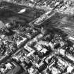
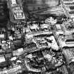
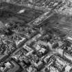
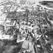
Edinburgh, High Street, Parliament Square


Tenement (17th Century)
Site Name Edinburgh, High Street, Parliament Square
Classification Tenement (17th Century)
Alternative Name(s) Parliament Close
Canmore ID 52296
Site Number NT27SE 275
NGR NT 25732 73543
Datum OSGB36 - NGR
Permalink http://canmore.org.uk/site/52296


- Council Edinburgh, City Of
- Parish Edinburgh (Edinburgh, City Of)
- Former Region Lothian
- Former District City Of Edinburgh
- Former County Midlothian
NT27SE 275 257 735
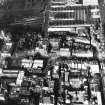
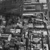
'This tenement stood on what is now the E side of Parliament Square and, though it possessed no features of architectural interest, it was remarkable as being the highest building in Edinburgh. It had seven storeys towards Parliament Close and fifteen towards the Cowgate, where the ground dropped sharply away. It was entirely destroyed by the great fire of 1700.'
RCAHMS 1951.
Publication Account (1951)
82. A high building in Parliament Close.
This tenement stood on what is now the E. side of Parliament Square and, though it possessed no features of architectural interest, it was remarkable as being the highest building in Edinburgh. It had seven storeys towards Parliament Close and fifteen towards the Cowgate, where the ground dropped sharply away. It was entirely destroyed by the great fire of 1700.
RCAHMS 1951

