
Following the launch of trove.scot in February 2025 we are now planning the retiral of some of our webservices. Canmore will be switched off on 24th June 2025. Information about the closure can be found on the HES website: Retiral of HES web services | Historic Environment Scotland
Edinburgh, Forrest Road


Gateway (Period Unassigned)
Site Name Edinburgh, Forrest Road
Classification Gateway (Period Unassigned)
Canmore ID 52155
Site Number NT27SE 14.08
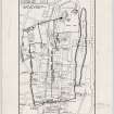
NGR NT 2570 7312
Datum OSGB36 - NGR
Permalink http://canmore.org.uk/site/52155


- Council Edinburgh, City Of
- Parish Edinburgh (Edinburgh, City Of)
- Former Region Lothian
- Former District City Of Edinburgh
- Former County Midlothian
NT27SE 14.8 2570 7312
Maps by Bryce and RCAMS show a gateway in the Telfer Wall (1628-36) at the S end of what is now Forrest Road; it is noted as '18th century gate' by the latter.
W M Bryce 1909; RCAHMS 1951.

