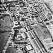
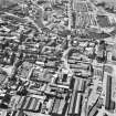
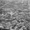
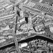
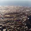
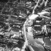
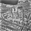
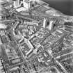
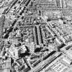
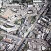
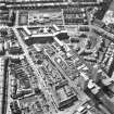
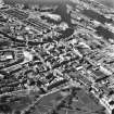
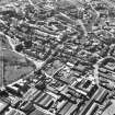
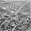
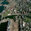
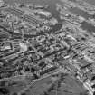
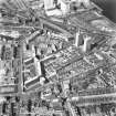
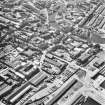
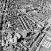
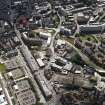
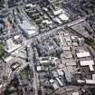
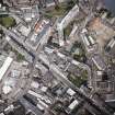
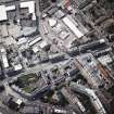
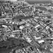
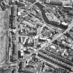
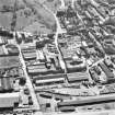
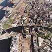
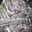
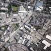
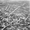
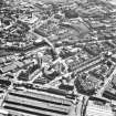
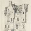
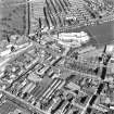
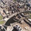
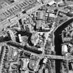
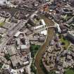
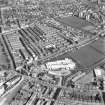
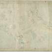
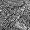
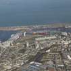
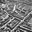
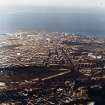
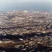
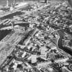
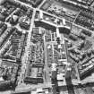
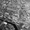
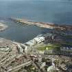
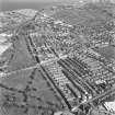
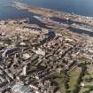
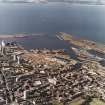
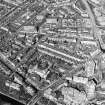
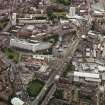
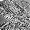
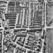
Edinburgh, Leith, General
Burgh (Medieval)
Site Name Edinburgh, Leith, General
Classification Burgh (Medieval)
Alternative Name(s) North Leith; South Leith
Canmore ID 51962
Site Number NT27NE 45
NGR NT 2670 7630
NGR Description Centred on NT 2670 7630
Datum OSGB36 - NGR
Permalink http://canmore.org.uk/site/51962
- Council Edinburgh, City Of
- Parish Edinburgh (Edinburgh, City Of)
- Former Region Lothian
- Former District City Of Edinburgh
- Former County Midlothian
NT27NE 45 centred on 2670 7630
First mention of Leith was in a Charter David I authorising the erection of the Abbey of Holyroodhouse in 1128 when it was known as Inverleith. There were two towns, north and south, in the 13th century. The former was governed by the Abbot of Holyrood and the latter, by the lairds of Restalrig. In 1398 Robert I granted its harbours and mills to the magistrates of Edinburgh who purchased South Leith in 1398. The town was burnt and pillaged by the English under the Earl of Hertford in 1544 and 1547 (Battle of Pinkie). It was fortified by Sieur d'Esse in 1548, besieged in 1559, and the western part of the fortifications were removed in 1563. Cromwell erected in citadel there in 1650.
J Russell 1922.
Though North Leith and South Leith appear as burghs in 1367, this is perhaps an error. They are classed as 'burghal suburbs' by Professor Pryde. Leith was erected de novo burgh of barony (city of Edinburgh) in 1636. (For Leith Citadel, see NT27NE 10.)
G S Pryde 1965.
NT27NE 45 centred on 2670 7630
NMRS REFERENCE:
J & J Todd & Son, Leith
The National Trust Survey (1938) mentions the Citadel, Andrew Lamb's House, St Ninian's Steeple, and No.38 Quality Street as being the most outstanding of the old buildings of interest in Leith.
Classification: 3A, 4B, 4C houses.
Photographs - No.38 Quality St., Kirkgate, 36-43 the Shore. 4 plates. National Trust Survey Midlothian (Leith) List Numbers 5, 8, 9.
Leith, The Cottage
NMRS SLIDES:
1 colour slide, missing at time of upgrade (27.5.1999).
Edinburgh, Leith Mission Halls.
ARCHITECT: Malcom Stark.
Precise location uncertain at time of upgrade 21.12.1999.
Edinburgh, Leith Spurgeon Memorial Temple.
ARCHITECT: D.A. Crombie 1893, Edinburgh.
Precise location unceertain at time of upgrade 21.12.1999.
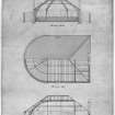
Edinburgh, Leith Drawbridge.
Sources: Dean of Guild. Bundle 1807, June - December. 30.7.1807
Pet. James Fyfe, Builder (1 Antigua St. PO Directory).
Drawbridge - West end between South and North Leith, South side.
Plan and elevation. Signed by architect - Alexander Stevens.
J & J Todd & Son, Leith
PLANS:
Dick Peddie & MacKay, Edinburgh alts
Thos McCrae 1936
PLANS:
Dick Peddie & McKay, Edinburgh alts
Dick Peddie, McKay & Jamieson 1951
NMRS PRINTROOM:
Inglis Photograph Collection, Acc no 1994/90
Two detailed plans of shore/dock are showing sewage plan and proposed overflow.
Edinburgh, Leith Mission Halls.
ARCHITECT: Malcom Stark.
Precise location uncertain at time of upgrade 21.12.1999.
Edinburgh, Leith Spurgeon Memorial Temple.
ARCHITECT: D. A. Crombie 1893, Edinburgh.
Precise location uncertain at time of upgrade 21.12.1999.
Edinburgh, Leith, unidentified church.
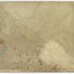
DC 6709 South Leith - church graded gallery land plan.
Black ink and watercolour, scale 1"-6'.
Dated December 1820, signed Thomas Brown.
816 x 610, YDA 2454 L 533.
Acc.No 1986/9.
Permission to reproduce: City Archivist.
Edinburgh, Leith, row of unidentified houses.
Sources: Dean of Guild 20.1.1814
James Thomson, builder in Leith.
Near the golfhouse, Leith.
Plan and elevations unsigned.
Row of houses, five pairs of entrance doors.
Edinburgh, house (property of Thomas Muir and James Cant, wrights), foot of Leith Walk. Particulars from David Henderson, architect, 1768.
(Edinburgh Evening Courant, May 30, 1768).
Edinburgh, Leith.
Sources: Dean of Guild. Bundle 1811 14.3.1811
Pet. Peter and Christopher Wood. Sands of Leith. Warehouses for Whalefishing trade.
Plan and elevations.
Edinburgh, Leith.
Sources: Dean of Guild. Bundle 1811. 14.3.1811
Pet. Peter and Christopher Wood.
Sands of Leith.
Warehouses for Whalefishing trade.
Plan and elevation elevation encl. Initialled P. and C. Wood.
Sources: Dean of Guild. Bundle 1813. January - June 8.4.1813
Pet. Matthew Allan, Druggist, with concurrence of J. Barclay of the Custom Leith, his landlord.
Alterations to shop front.
Plan and elevation encl. Signed J.B.
Sources: Dean of Guild. Bundle 1811. 11.4.1811
Pet. of Messrs. Corbet and Borthwick and Co., Merchants, Leith.
Wet docks of Leith - near.
Plan and elevation of warehouse - towards wet dock.
- towards citadel.
Signed as a true copy by John Paterson.
Sources: Dean of Guild. Bundle 1811. 23.5.1811
Pet. Messrs. Douglas and Brodie, merchants in Leith. Wet Docks, Leith, South side.
Warehouse.
Plan and elevation encl. - "Compared with the original John Paterson".
Sources: Dean of Guild. Bundle 1815. July - December 15.7.1813
Pet. Wauchope and Moodie, wine merchants, Leith.
"The old Marble Yard, Leith, bounded by -
on North-East prop. of Robt. Anderson.
on North-West prop. of Ellis Martin.
on South-East by Great Road from St. Bernards Street to the sands.
Plan and elevation, warehouses and cellars etc. unsigned.
Sources: Dean of Guild. Bundle 1815. July - December 19.8.1813
Pet. David Ogilvy, for Edinburgh Roperie Co. Leith.
Within their property near the Links.
Proposed to demolish and re-erect warehouse etc.
Plan and elevation. Unsigned.
Sources: Dean of Guild 14.10.1813
Pet. William Aitchison of Dunsmore.
Leith, tenement formerly the Weigh House - precise location unknown at time of upgrade, 8.2.2000
Proposed hatchways into cellars at front of building.
Plan and elevation, unsigned.
Shows two floor five door tenement with entry marked "to Ramsay and Williamsons".
Sources: Dean of Guild 2.6.1814
Pet. John Martin, Merchant in Queensferry.
Corner tenement fronting the Citadel of Leith, near to the West end of therof - - precise location unknown at time of upgrade, 8.2.2000
Minor alterations - door.
Plan of whole tenement unsigned.
Publication Account (1951)
223. Leith: its Port and Streets.
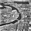
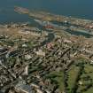
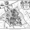
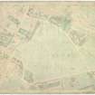
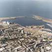
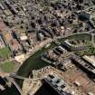
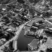
The original harbour of the seaport mentioned in the 12th century Great Charter of Holyrood was simply the lower reach of the Water of Leith, and it did not extend farther down-stream than Broad Wynd. The docks and warehouses that now exist between this former limit and the foreshore have all come into being in the last two centuries, and the street on the E. bank of the stream is still known as "The Shore." Previous to the time of its destruction at the hands of the English in 1547 Leith, like other Scottish seaports, was a very small place. This is clearly shown by the extent of the fortifications thrown up in the following year by Monsieur D'Esse, commander of the French troops supporting the Regent, Queen Marie de Guise-Lorraine, which actually enclosed the whole area of the town. This system, which was octagonal in shape, straddled the mouth of the river, a timber bridge placing the two banks in communication. The works consisted of a rampart and ditch, strengthened at the corners by eight projecting bastions, two of which, built of stone and situated respectively at the Sandport in North Leith and at the W. end of the present Bernard Street* in South Leith, guarded the approach to the harbour. From the second of these, which was known as Ramsay's Mount, the rampart trended eastwards, parallel with Bernard Street, to a bastion situated where the Corn Exchange Buildings now stand. It then turned S.S.W. and followed the line of Constitution Street as far as a fourth bastion, placed at the junction with Coatfield Lane. From this point it ran towards a fifth bastion at the top of the Kirkgate. The position of the sixth bastion is uncertain. The seventh stood on the W. bank of the river. The eighth appears to have stood where the Citadel (No. 230) rose a century later. In the rampart were seven gates or" ports," that of St. Anthony, situated at the S. end of the Kirkgate, being the principal entry on the landward side. The scanty remains of two counterworks are noted under No. 247.
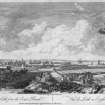
Notwithstanding the facts that the Queen-Regent interested herself in Leith and occupied a house there and that several members of the Court followed her example, the port still appears as very small in comparison with Edinburgh in a contemporary drawing of the siege of the capital in1573 (Fig. 61). North Leith, for instance, on the left bank of the stream, is merely a village on the water-front, while South Leith, on the opposite bank, is shown as a little town built round two main cross-streets. The two communities had been united by a bridge as early as 1439, the name Old Bridgend, which attaches to the junction of Coalhill and Sheriffbrae, indicating the position of one end. The same drawing shows the fortifications of 1548 and 1581 still enclosing the town, as they continued to do for the better part of two centuries after the date at which it was made.
In 1650 Sir David Leslie, commander of the Scottish forces that were opposing Cromwell, threw up a strong earthen breastwork between the capital and its port. This became the path known as the Walk, and ultimately developed into the principal means of communication between the two towns. It is now a street, Leith Walk, which traverses a densely built-up area.
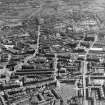
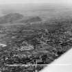
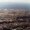
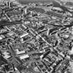
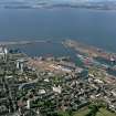
For one reason and another** the growth of Leith was long retarded, and at the end of the reign of George I. the seaport covered less ground than the S. part of the burgh of Edinburgh. Within a century, however, it expanded greatly as a result of improvements made to the harbour; and the rate of expansion increased further after 1832, when the passing of the Reform Bill removed many of the disabilities under which the port had previously laboured.
RCAHMS 1951, visited c.1941
*The position now occupied by Numbers 32-5, The Shore
**E.g., the ravages of the plague of 1645-6,which carried off two-thirds of the population


