Accessibility

Font Size

100% 150% 200%

Background Colour

Default Contrast
Close Reset

Edinburgh, Leith Docks, Albert Dock, Prince Of Wales Dry Dock

Dry Dock (19th Century)

Site Name Edinburgh, Leith Docks, Albert Dock, Prince Of Wales Dry Dock

Classification Dry Dock (19th Century)

Alternative Name(s) Prince Of Wales Graving Dock

Canmore ID 51922

Site Number NT27NE 57.18

NGR NT 27168 76891

Datum OSGB36 - NGR

Permalink http://canmore.org.uk/site/51922

Ordnance Survey licence number AC0000807262. All rights reserved.
Canmore Disclaimer. © Bluesky International Limited 2025. Public Sector Viewing Terms

Toggle Aerial | View on large map

Digital Images

View from NNE showing S lock gate at entrance to Albert Dock with workshops and part of pumping station in background
View from NNE showing S lock gate at entrance to Albert Dock with workshops and part of pumping station in backgroundView from E showing NNE and ESE fronts of workshops with part of pumping station in backgroundView from ENE showing steam crane no 8View from ENE showing steam crane no 8View from ESE showing barge Grab no 1View from ENE showing N and E fronts of junction box with part of bridge in backgroundOblique aerial view centred on the swing bridge, road bridge, harbour, office and dry dock, taken from the SW.View from North East.View from ENE showing coaster MV Fylhix moored on wharf opposite dry dock entranceDetail of dock gate mechanism.Detail of lock gate mechanism.View from North East.View from East.View from ENE showing NNE and ESE fronts of pumping stationView from ESE showing dry dock with lock gates closedView from SE showing barge Grab no 1 and craneDetail of lock gate mechanism from West.Detail of lock gate mechanism.View from East.View from SSW showing detail of sluice mechanismView from East.General view from ESEView from SSE showing SSW and ESE fronts of pumping stationView from WNW showing dry dockOblique aerial view centred on the swing bridge, road bridge and office with the harbour, dock and dry dock adjacent, taken from the SW.Detail of dock gates from East.View from NNE showing dry dock gates with NNW front of bridge in backgroundView from W showing barge Grab no 1Oblique aerial view centred on the swing bridge, road bridge, harbour, office and dry dock, taken from the WSW.View from East.General view from SE.Detail of brickwork.Edinburgh, Prince Of Wales Graving Dock, NT27NE 104, Ordnance Survey index card, RectoView South East.View from SSW showing barge Grab no 1 with SSW front of pumping station in background

Administrative Areas

  • Council Edinburgh, City Of
  • Parish Edinburgh (Edinburgh, City Of)
  • Former Region Lothian
  • Former District City Of Edinburgh
  • Former County Midlothian

Archaeology Notes

NT27NE 57.18 27147 76863

Formerly entered as NT27NE 104.

See also NT27NE 57.38.

For associated hydraulic power station (NT 27134 76935), see NT27NE 57.19.

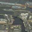
This former dry dock is depicted, but not noted, on the 1970 edition of the OS 1:1250 map. It is situated to the S of the Albert Dock Basin (NT27NE 57.16) and is the larger of a parallel pair, the other being the Alexandra Dry Dock (NT27NE 57.26), which is adjacent (to the S).

Information from RCAHMS (RJCM), 13 June 2006.

References

MyCanmore Image Contributions


Contribute an Image

MyCanmore Text Contributions