Scheduled Maintenance
Please be advised that this website will undergo scheduled maintenance on the following dates: •
Tuesday 12th November from 11:00-15:00 & Thursday 14th November from 11:00-15:00
During these times, some services may be temporarily unavailable. We apologise for any inconvenience this may cause.
Woodhouselee
Field Boundary(S) (Period Unassigned), Rig And Furrow (Medieval) - (Post Medieval)
Site Name Woodhouselee
Classification Field Boundary(S) (Period Unassigned), Rig And Furrow (Medieval) - (Post Medieval)
Canmore ID 51901
Site Number NT26SW 47
NGR NT 23065 64958
NGR Description NT 23065 64958 (centre)
Datum OSGB36 - NGR
Permalink http://canmore.org.uk/site/51901
- Council Midlothian
- Parish Glencorse
- Former Region Lothian
- Former District Midlothian
- Former County Midlothian
NT26SW 47 23065 64958 (centre)
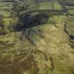
There is an extensive area of broad sinuous rig on the E flank of Castlelaw Hill and the SW flank of Woodhouselee Hill, lying to either side of a small watercourse (RCAHMSAP 2004).
Information from RCAHMS (DCC) 2 September 2004
A large area of rig has been recorded on oblique aerial photography (RCAHMSAP 2000) lying between Woodhouselee Hill and Castlelaw Hill, about 600m NW of Woodhouselee. Field banks can be seen within the rig, some of which are depicted on the current edition of the OS 1:10000 map (1983).
Information from RCAHMS (KMM) 15 December 2004.


