Following the launch of trove.scot in February 2025 we are now planning the retiral of some of our webservices. Canmore will be switched off on 24th June 2025. Information about the closure can be found on the HES website: Retiral of HES web services | Historic Environment Scotland
Ravensneuk Castle
Castle (Medieval)
Site Name Ravensneuk Castle
Classification Castle (Medieval)
Canmore ID 51650
Site Number NT25NW 7
NGR NT 2228 5901
Datum OSGB36 - NGR
Permalink http://canmore.org.uk/site/51650
- Council Midlothian
- Parish Penicuik (Midlothian)
- Former Region Lothian
- Former District Midlothian
- Former County Midlothian
NT25NW 7 2228 5901.
(NT 2228 5901) Ravensneuk Castle (NR) (Remains of)
OS 6" map (1957)
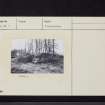
The remains consist only of the N wall with a portion of the gable return built of freestone rubble and now nowhere more than 6' high. The N wall is 59' long, of which the western 39 1/4' is unvaulted. The eastern portion appears to be the older and is vaulted.
RCAHMS 1929, visited 1920
Dated to 1527.
I C Hannah 1928
This castle was robbed by the first Sir John Clerk (1650-1722) to build a park wall.
J Gray 1895
The remains of Ravensneuk Castle are as described above; they are in a poor condition and the walls are up to 1.0m thick and 1.5m high.
Visited by OS (DT) 6 December 1962
This area has been newly planted with trees but the remains of Ravensneuk Castle are as described previously.
Visited by OS (BS) 4 November 1975


