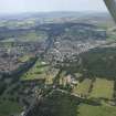
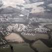
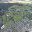
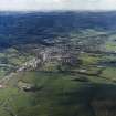
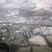
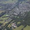
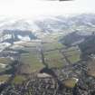
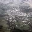
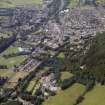
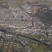
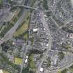
Accessibility

Font Size

100% 150% 200%

Background Colour

Default Contrast
Close Reset

Peebles, General

Burgh (Medieval), Town (Period Unassigned)

Site Name Peebles, General

Classification Burgh (Medieval), Town (Period Unassigned)

Canmore ID 51487

Site Number NT24SE 49

NGR NT 25333 40475

NGR Description Centred on NT 25333 40475

Datum OSGB36 - NGR

Permalink http://canmore.org.uk/site/51487

Ordnance Survey licence number AC0000807262. All rights reserved.
Canmore Disclaimer. © Bluesky International Limited 2025. Public Sector Viewing Terms

Toggle Aerial | View on large map

Digital Images

General oblique aerial view of the town with the hotel in the foreground, taken from the ESE.
General oblique aerial view of the town with the hotel in the foreground, taken from the ESE.General view  of Peebles showing church and road bridgeGeneral view of Peebles from the HydroView of railway track, possibly near PeeblesOblique aerial view.Peebles, General, NT24SE 49, Ordnance Survey index card, RectoGeneral oblique aerial view of Peebles centred on Peebles Golf Course, taken from the SE.General view across the River Tweed towards Peebles showing church and road bridgeView of flock of sheep on road, possibly in the Peebles areaDistant view of Peebles from the HydroGeneral oblique aerial view of Peebles, taken from the NNW.Oblique aerial view.General oblique aerial view of the town with the hotel in the foreground, taken from the ENE.Oblique aerial view.View of River Tweed, with distant view of PeeblesOblique aerial view.General view of Peebles showing millsGeneral view of Peebles from south of the River TweedGeneral oblique aerial view of Peebles, taken from the NNW.General oblique aerial view of Peebles, taken from the NW.General view along the River Tweed towards PeeblesGeneral view of PeeblesDistant view of Peebles showing man by stone wallView of the River Tweed looking upstream with Neidpath Castle visible in the distanceGeneral oblique aerial view of the town with the hotel in the foreground, taken from the E.General oblique aerial view of Peebles, looking N.General view of Springhill, PeeblesView of railway track, possibly near PeeblesDistant view of Pebbles, with the Morning Hill Golf Course pavilion in the foreground.
General oblique aerial view of Peebles, taken from the NNW.General view of River Tweed near Peebles with man fishing.
General oblique aerial view of Peebles, looking ENE.General oblique aerial view of Peebles, taken from the ENE.Sketch showing distant view of Peebles.View of River Tweed, with distant view of Peebles

Administrative Areas

  • Council Scottish Borders, The
  • Parish Peebles
  • Former Region Borders
  • Former District Tweeddale
  • Former County Peebles-shire

Archaeology Notes

NT24SE 49 25333 40475.

An early burgh of king David I, 1124 x 1153.

G S Pryde 1965.

Activities

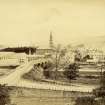
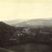
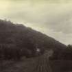
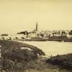
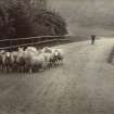
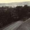
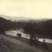
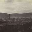
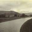
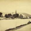
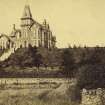
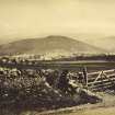
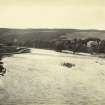
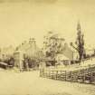
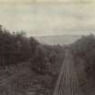
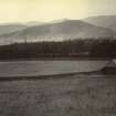
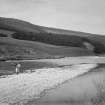
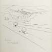
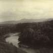
Photographic Record (1896)

Photograph album with views from the Scottish Borders in 1896 including Peebles

Photographic Survey (1956)

Photographs of buildings in Peebles by the Scottish National Buildings Record in 1956.

Photographic Survey (July 1957)

Photographs of buildings in Peebles by the Scottish National Buildings Record in 1957.

References

MyCanmore Image Contributions


Contribute an Image

MyCanmore Text Contributions