
Pricing Change
New pricing for orders of material from this site will come into place shortly. Charges for supply of digital images, digitisation on demand, prints and licensing will be altered.
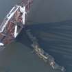
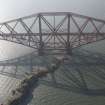
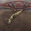
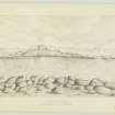
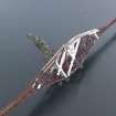
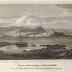
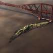
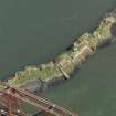
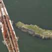
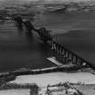
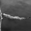
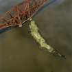
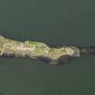
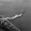
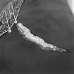
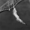
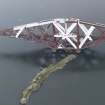
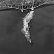
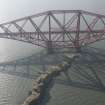
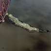
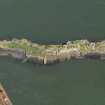
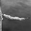
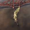
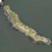
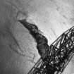
Inch Garvie Castle


Castle (Medieval)
Site Name Inch Garvie Castle
Classification Castle (Medieval)
Alternative Name(s) Inchgarvey; Inchgarvie Island; Inch Garvie; Firth Of Forth
Canmore ID 50470
Site Number NT17NW 10
NGR NT 1368 7951
Datum OSGB36 - NGR
Permalink http://canmore.org.uk/site/50470


- Council Edinburgh, City Of
- Parish Dalmeny
- Former Region Lothian
- Former District City Of Edinburgh
- Former County West Lothian
NT17NW 10 1368 7951
(NT 1368 7951) Castle (NR)
(Ruins of)
OS 6" map (1948).
Fort (NR) (rems of)
OS 6" map (1968).
See also NT17NW 9 and NT17NW 13.
The island of Inchgarvie was granted to John Dundas in 1491 by James IV with power to build a fort upon it. He did not do this, and James IV himself ordered a strong tower to be built in 1513.
R Sibbald 1803; New Statsitical Account (NSA) 1845.
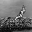
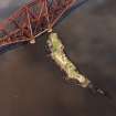
This castle is understood to have been erected in the reign of James IV and to have been subsequently used as a state prison, being fortified at that time. It was repaired and mounted with cannon during the late (? Napoleonic) war. The buildings and battery (NT17NW 13) are now ruinous.
Name Book 1854
The castle was occupied by Royalist troops during Cromwell's campaign in 1650-1.
(For further details, see NT17NW 9).
W S Douglas 1898
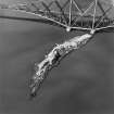
The remains of this castle are incorporated in modern defensive works of concrete. The remains are those of the E side of the castle and several small narrow embrasures and a filled-in arched doorway are visible.
Visited by OS (JD) 12 March 1955.
Scheduled (with NT17NW 9 and NT17NW 13) as Inch Garvie, Firth of Forth, defensive installations.
Information from Historic Scotland, scheduling document dated 19 August 1996.
A fort was built on the island in 1513 by James IV. It was subsequently used as a state prison until the purchase of the Bass Rock in 1671 (Dickson 1899, ). During the Civil wars it was occupied by Royalist troops. It was repaired and mounted with canon in the Napoleonic war. By 1854 (Name Book) the fortifications were described as ruinous. These remains were incorporated into the modern defensive works of the 2WW. The anti-aircraft battery can be seen on the 1947 aerial photographs. B136 4010-11 22/6/47.
Site recorded by GUARD during the Coastal Assessment Survey for Historic Scotland, 'The Firth of Forth from Dunbar to the Coast of Fife' 1996.
REFERENCE
'Dundas of Dundas' Ed. A MacLeod, 1897 - 1 photograph

