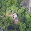
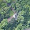
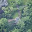
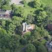
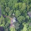
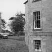
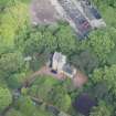
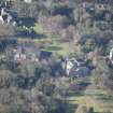
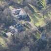
Edinburgh, Cramond, Kirk Cramond, Cramond Tower
Tower House (Medieval)
Site Name Edinburgh, Cramond, Kirk Cramond, Cramond Tower
Classification Tower House (Medieval)
Alternative Name(s) 4 Kirk Cramond; Cramond Glebe Road
Canmore ID 50421
Site Number NT17NE 4
NGR NT 19092 76963
Datum OSGB36 - NGR
Permalink http://canmore.org.uk/site/50421
- Council Edinburgh, City Of
- Parish Edinburgh (Edinburgh, City Of)
- Former Region Lothian
- Former District City Of Edinburgh
- Former County Midlothian
NT17NE 4 19092 76963
(NT 1909 7695) Cramond Tower (NR) (remains of)
OS 6" map (1968)
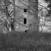
Cramond Tower probably dates from the late 15th - early 16th century; it measures 21'8" N-S by 24'9" E-W, with a circular stair-tower projecting from the SE angle. It is now free-standing, four storeys high, but at sundry periods outbuildings of various heights have been erected against the N, E and W walls, though these have disappeared. It is not in a good state of preservation (N Tranter 1963). The tower must have been built by the Bishops of Dunkeld.
RCAHMS 1929, visited 1921; D MacGibbon and T Ross 1889
No change to previous information.
Visited by OS (BS) 11 December 1975
Now restored and occupied.
N Tranter 1990.
Field Visit (3 February 1921)
Cramond Tower.
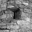
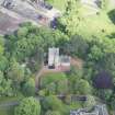
Within the parks of Cramond House, and only a few yards distant from the mansion, stands the ruin of Cramond Tower, which probably dates from the late 15th or early 16th century. The site, which is at the mouth of the Almond, has been in occupation from an early period. The tower is, on plan, an oblong measuring externally 21 feet 8 inches from north to south by 24 ¾ feet from east to west; from the south-east angle there projects a circled stair-tower. Beneath the wall-head there are four storeys, of which the lowest and the uppermost are ceiled with barrel-vaults.
The tower is, to-day, freestanding, as it was originally, but at one period of its existence there stood against the east wall a three-storeyed addition, while a four-storeyed extension was reared against the west wall; against the north wall there may have been a two-storeyed addition. These outbuildings communicated with the main building on the upper floors, but only the western communicated at basement-level. The masonry of the tower is freestone rubble with dressed corners, and shell pinnings are extensively employed. The entrance is at ground level in the south wall at its junction with the stair-tower. The doorway has had a semicircular head, rebated, like the jambs, to accommodate outer and inner doors, but the outer rebate of the head has subsequently been cut upwards to accommodate a rectangular in place of a circled door-head. Above the entrance is a small lintelled window with arrises chamfered like those of the doorway. The upper windows are also lintelled and have their arrises variously rebated and chamfered. The stair lights are narrow.
In rear of the entrance a lobby, contrived within the thickness of the south wall, gives access to the basement on the north through an obtusely pointed arch-headed doorway, and to the staircase on the east through a lintelled doorway. The stair is a vice 2 feet 6 inches wide; it ascends from ground level to the extrados of the upper vault, where it has terminated in a cap-house. In passage it gave access to the single chamber, contained on each floor.
The basement floor is beneath the entrance level. The chamber measures 15 feet 7 inches by 11 feet 10 inches, is ceiled with a pointed barrel vault, and, at present, is lit only from the window above the entrance, though the access to the west outbuilding may originally have been a light. The first-floor chamber or hall had in each wall a window, lintelled externally, but with segmental scontion arches; two windows, on being closed up, were utilised as cupboards, the fronts being panelled in Memel pine. At the southern light the sill has been lowered, and the wall in which it is set is thinned to increase the floor area, the impending wall above being borne, not on an arch, but on timber beams. In the west wall is the fireplace, which, at a subsequent period, was contracted. The original jambs, which are rounded at the arris, are flush with the wall face; the projecting hood is borne on a thin stone lintel, supported by corbels at either end. The original stone kerb remains in situ. Within the embrasure of the adjoining window, which subsequently became an access to the west outbuilding, is a slop drain. The second floor had a window to north and to south, and a third formed in the breast of the fireplace. The southern window has stone seats at the jambs. The fireplace retains its stone kerb and has a projecting hood. The lintel is arched segmentally and is borne on two corbels. At the south end of the east wall is a mural garderobe, which had a seat and, presumably, a soil flue. The third storey is ceiled with a semicircular barrel-vault and is lit from the east only. The window lintel is corbelled to reduce its span. The outer surface of the vault is densely covered with vegetation which obscures any features that may exist.
The enclosing wall of the kennels [NT17NE 273], which lie some 60 yards west of the tower, contains masonry which is at least as old as the 17th century; at the south-east corner of the enclosure is a vaulted cellar, off which and to the east lay a second structure. The access between these is filled in, and in the infilling is a stone which exhibits Roman diamond dressing.
HISTORICAL NOTE.-The original tower was probably that of the bishops of Dunkeld (1). In 1507 there is a note in the episcopal records of ‘repair of the place of Crawmound’ (2).
RCAHMS 1929, visited 3 February 1921.
(1) See Note on No. 37; (2) Rentale Dunkeldense (Scot. Hist. Soc.), p. 246.
Watching Brief (1950 - 2000)
NT 1913 7694
Large stone-built drain, with grating, found to SE of Tower, aligned approx NS between Cramond House and shore.
Information from E.A.F.S.
Photographic Survey (November 1959 - December 1959)
Photographic survey by the Scottish National Buildings Record in 1959.
Excavation (1977)
NT17NE 79 c. 1906 7696
Excavation W of Cramond Tower (NT17NE 4 at NT 1909 7695) on the presumed site of a chapel built for the Bishop of Dunkeld in the early 15th century located two fragments of stone wall and a door-jamb. A pit cut into the natural adjacent to the tower contained fragments of 18th century glass bottles.
N M M Holmes 1977.
Excavation (1978 - 1981)
NT 1906 7696
Excavation on W of Cramond Tower revealed two fragments of stone wall and a door jamb. A pit cut into the natural adjacent to the tower contained fragments of 18th century pottery. Relates to NH excavation area T.
Mortared building foundations a few metres W of Cramond Tower, possibly on the same alignment. Small round bronze button-like object with enamelled decoration of human bust retrieved, possibly a religious item.
Information from E.A.F.S.
Excavation (1978)
NT 191 769
A trench just N of the NE corner of the fort revealed that the inner fort ditch continued northwards to form the eastern boundary of a military annexe which would have enclosed the bathhouse (Disc and Exc Scotland 1975 and 1976, Current Archaeology 59). The ditch profile, almost identical to that of the inner fort ditch in the manse garden, had been re-cut.
Excavation (1980 - 1981)
NT 1910 7696
East side of Cramond Tower. Mortared wall foundations; Late rectangular addition to tower. On same bedding of clay and boulders as tower. Much glass found.
Excavation (1981)
NT 191 769
A Roman boundary ditch was discovered in the area immediately S of Cramond Tower, running at right angles to the projected line of the E ditch of the annex (Discovery Excav Scot 1978, I5), The upper levels had been destroyed by early 19th century land clearance, and the surviving portion of the ditch was of standard V-shaped profile with a width of 1.77m and a maximum depth of 1.10m. Initial silting had been followed by a partial recut and finally by deliberate backfilling. Pottery finds suggest an Antonine origin for the ditch, with the recut and backfilling occurring at the beginning and end of the Severan occupation.
The ditch had been cut by the digging of a pit which had been filled with large stones: its date and context are unknown. To the S of the ditch was part of a roughly cobbled footpath, c.1m wide, running almost parallel to the ditch. The surface sealed pottery of 17th century type.
N. M. McQ. Holmes
Geophysical Survey (2006)
Edinburgh Field Archaeological Society were granted permission to conduct a geophysical survey at Cramond Tower. Three 20m x 20m squares were laid out and surveyed. An irregular low resistance line was recorded, and is thought to be a Roman ditch, parts of which were recorded when a pond was dug for the garden. A now unused drain from the 1680 Cramond House was also recorded in the survey.
H M D Jones 2006.
Aerial Photographic Interpretation
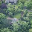
Crop mark showing two parallel curved features below NE corner of flat area in front of E front of Cramond House.
CUCAP BD-50 Aerial photo


