Dalmahoy Hill
Fort (Prehistoric) - (Early Medieval), Hut Circle (Prehistoric)
Site Name Dalmahoy Hill
Classification Fort (Prehistoric) - (Early Medieval), Hut Circle (Prehistoric)
Canmore ID 50318
Site Number NT16NW 1
NGR NT 13550 66930
Datum OSGB36 - NGR
Permalink http://canmore.org.uk/site/50318
- Council Edinburgh, City Of
- Parish Ratho
- Former Region Lothian
- Former District City Of Edinburgh
- Former County Midlothian
NT16NW 1 13550 66930
See also NN72SW 3, NT17NE 12 and NO32SW 22.
Fort (NR)
OS 6" map (1958).
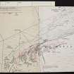
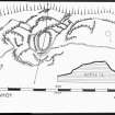
(NT 135 669) Fort, Dalmahoy Hill. The remains of this fort occupy the twin eminence to that upon which the Kaimes Hill Fort (NT16NW 2) stands. They represent two structural periods, the earlier of which is very difficult to interpret. Briefly, the craggy and uneven hill was enclosed by a system of stone walls which defended an area measuring 1200ft in length by a maximum of about 400ft in width, bordered on the NW by the precipitous face of the hill. The second phase structure is an oval enclosure on the very summit of the hill, which measures 140ft by 85ft. This enclosure must occupy the same ground as did the central feature of the Fort.
While there is no reason to suppose that the earlier works are not of pre-Roman Iron Age date, the period at which the later enclosure was built has not yet been established. There is reason to believe that it may be of post-Roman date, as it belongs to a class of such monuments which are almost always found to overlie pre-Roman forts and which have, in some cases, produced relices of early medieval (Dark Age) date.
A gold stud-cap 1/5 ins in diameter was picked up in the Dalmahoy secondary enclosure, as were several fragments of moulds, all of which can be assigned to that late period. Only excavation could answer the problem satisfactorily.
In the area centred NT 1343 6673 are the remains of a hut circle, with an internal diameter of 19ft. There is an inner facing of stones set on edge. The entrance has been from the east.
RCAHMS 1929; R B K Stevenson 1951; R W Feachem 1963.
This fort is as described above. Feature 'A' on Stevenson's plan cannot be positively identified.
Re-surveyed at 1/2500.
Visited by OS (WDJ) 10 September 1965
Aerial Photography (April 1967)
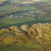
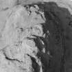
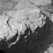
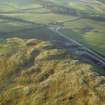
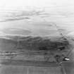
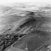
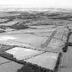
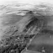
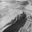
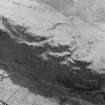
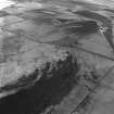
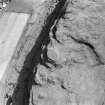
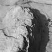
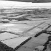
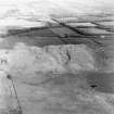
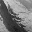
Oblique aerial photographs of Dalmahoy Hill Fort, Midlothian, photographed by John Dewar in April 1967.
Note (2 November 2015 - 31 August 2016)
The small fort on the rocky summit of Dalmahoy Hill lies at the core of a series of outer enclosures, the walls of which follow natural terraces between outcrops and block off access up and down the gullies on the SE and SW flanks of the hill. The fort crowning the summit is oval on plan and measures about 43m from N to S by 25m transversely (0.08ha) within a heavily robbed robbed wall some 3.6m in thickness. Where runs of outer face survive on the E and S, this wall has measured at least 3m in height and there is an entrance on the NE, opening externally onto a terrace with traces of walling around its lip and an outer entrance. While the RCAHMS investigators who first drew up a plan of the fort in 1926, recognised this outer entrance and traces of walling between the outcrops around the W flank, it was not until 1948 that the full extent of the outer enclosures taking in the whole hilltop was recognised, including a major enclosure extending for about 200m along the ridge to the ENE, and a series of lesser walls combining with the outcrops to enclose the terraces stepping down from the fort on the W. The overall area enclosed measured some 360m in length from ENE to WSW and extends to about 2ha. The plan was traced out by Robert Stevenson and led him to identify the summit fortification as a citadel within an arrangement of contemporary outer enclosures, thus giving rise to the concept of a 'nuclear fort', a type that has become synonymous with early medieval fortifications. While the wall extending along the SE flank of the ridge-top is between 2.4m and 3m thick, the walls on the W appear of slighter construction, and Stevenson himself conceded that some of the lesser banks forming enclosures at the foot of the SW flank were possibly agricultural, but Feachem (1955, 78-9, fig 6; 1963, 137-8) at first accepted the broad outline of the hypothesis, albeit that he he subsequently considered the visible remains of the small summit fort to be a later insertion into what was probably an earlier Iron Age fort. This latter hypothesis seems inherently more likely today, but the full extent of this earlier fort is much less certain. It presumably took in the summit of the hill and the ridge to the ENE, and had one entrance in its SSE side opening into the gully on the E side of the summit, with perhaps a second at the N end of the gully, though the course of the perimeter on the NW side of the ridge is far from clear. Another entrance route seems to have mounted the W flank of the hill via a second gully, passing through at least two of the enclosure walls on this side, but without any obvious route to the entrance of the summit fort. Unlike the Dunion (Atlas No.3368), the obvious parallel for a large prehistoric fort formed of multiple enclosures, there are no traces of round-houses within any of the enclosures and the structure noted on the summit of the ridge by Stevenson is perhaps more likely to be the remains of a robbed cairn.
Information from An Atlas of Hillforts of Great Britain and Ireland – 31 August 2016. Atlas of Hillforts SC3698


