Pricing Change
New pricing for orders of material from this site will come into place shortly. Charges for supply of digital images, digitisation on demand, prints and licensing will be altered.
Upcoming Maintenance
Please be advised that this website will undergo scheduled maintenance on the following dates:
Thursday, 9 January: 11:00 AM - 3:00 PM
Thursday, 23 January: 11:00 AM - 3:00 PM
Thursday, 30 January: 11:00 AM - 3:00 PM
During these times, some functionality such as image purchasing may be temporarily unavailable. We apologise for any inconvenience this may cause.
Lochurd
Fort (Period Unassigned)
Site Name Lochurd
Classification Fort (Period Unassigned)
Canmore ID 50145
Site Number NT14SW 9
NGR NT 1169 4296
Datum OSGB36 - NGR
Permalink http://canmore.org.uk/site/50145
- Council Scottish Borders, The
- Parish Kirkurd
- Former Region Borders
- Former District Tweeddale
- Former County Peebles-shire
NT14SW 9 1169 4296.
(NT 1169 4296) Fort (NR)
OS 6" map (1968)
This is an oval bivallate fort, measuring internally about 240' by 150', almost ploughed-out, as a ridge. The ramparts are visible only at the NE and SW ends, as very low banks between 25 and 30' thick.
(Information from R W Feachem notebook 1959, 109)
RCAHMS 1967, visited 1959
This site is now under crop. The banks are ploughed out and no intelligible remains are visible.
Revised at 1:2500.
Visited by OS (WDJ) 16 July 1974 and (SFS) 6 November 1974
Note (15 October 2015 - 20 October 2016)
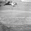
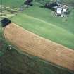
This fort is situated on the crest of the descending between the Lochurd and Hell's Cleuch Burns above Lochurd. Since it was first depicted on the OS 25-inch map (Peebles 1859, sheet 11.4), the fort has been considered to be oval, measuring about 70m from NE to SW by about 50m transversely (0.25ha) within twin ramparts, which had been heavily ploughed down by the time RCAHMS investigators drew up a plan on the ground in 1959. Since then the earthworks have been virtually obliterated, and the defences are now known only from cropmarks, which reveal two broad ditches. These are particularly clearly defined on the SW, and while the NE arc can be faintly detected, there is a strong impression that the SW ditches complete a circular circuit some 50m in diameter. This unexpected complexity to the defences can only be unravelled by further aerial photography or geophysical survey. The interior is featureless and no entrances are visible.
Information from An Atlas of Hillforts of Great Britain and Ireland – 20 October 2016. Atlas of Hillforts SC3638
Sbc Note (21 March 2016)
Visibility: This was the site of an archaeological monument, which may no longer be visible.
Information from Scottish Borders Council
Previously also listed under duplicate site NT96SW 510 -CANCELLED. HES (LCK) 11.6.2024


