Hog Hill
House Platform(S) (Prehistoric), Settlement (Prehistoric)
Site Name Hog Hill
Classification House Platform(S) (Prehistoric), Settlement (Prehistoric)
Alternative Name(s) Wester Happrew
Canmore ID 50054
Site Number NT14SE 3
NGR NT 1684 4212
Datum OSGB36 - NGR
Permalink http://canmore.org.uk/site/50054
- Council Scottish Borders, The
- Parish Stobo
- Former Region Borders
- Former District Tweeddale
- Former County Peebles-shire
NT14SE 3 1684 4212
(NT 1684 4212) Settlement (NR)
OS 6" map (1963).
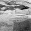
On the comparatively steep E flank of Hog Hill there is a fort measuring internally 210' by 160'. It has been enclosed by two continuous ramparts (A and B), which are separated by a dtich, while a third rampart (C), with an external ditch, has been added round the uphill (W) half only. Ramparts A and B have been largely destroyed by erosion and by a modern quarry on the E, but in other places the remains are still impressive. On the N the crest of rampart A is 5' in height internally and 9'6" in height externally, measured from the bottom of the ditch, while rampart B is 7' in height internally and 5' in height externally. Gaps in both the NE and SSE sectors of the ramparts probably represent original entrances.
The third rampart (C) is best preserved on the W, where it is 6' in height internally and 5' in height externally, measured from the bottom of the ditch, while the counterscarp of the ditch is 8' in height. On the WSW, rampart C diverges from its course to avoid two platforms, the upper of which (D) is bordered on the front by a scarp, and the lower (E) by the remains of a bank. These are presumably house platforms, constructed after all the space inside the fort defended by ramparts A and B was occupied, and subsequently given a measure of protection by the addition of rampart C.
The interior, which is slightly hollowed, contains several house platforms, as well as floors on different levels which may also have supported timber houses.
(Information from R W Feachem notebook 1959, 126)
RCAHMS 1967, visited 1959
The position of this earthwork suggests that it was a defended settlement of two phases rather than a fort.
Surveyed at 1:2500.
Visited by OS (DWR) 19 July 1971
Photographed by the RCAHMS in 1980.
(Undated) information in OS Archaeology Branch records.
Note (13 October 2015 - 18 May 2016)
This fort is situated on a moderately steep slope on the E flank of Hog Hill, which is an unlikely position for a fort. Nevertheless the strength of its defences around the uphill, NW and SW. flanks, comprising an inner circuit of two ramparts with a medial ditch, and an outer work of a single rampart with an external ditch, leaves little doubt to the intentions of its builders. Indeed, while the inner rampart stands some 1.5m high internally on the N, externally it falls 2.8m into the bottom of the flanking ditch, which averages about 6m in breadth; the medial rampart on the counterscarp here stands 1.5m high externally. These ramparts were probably originally rather slighter along the downslope, E, flank, but the inner has in any case been demolished and the outer reduced to a scarp, while a quarry has also been cut through them into the interior. The outer work is constructed on a similar scale, but appears to be an addition which may never have been carried around the E flank; roughly concentric around the NW, creating a multivallate belt some 35m deep, on the SW it diverges slightly to include two platforms, leading the RCAHMS investigators who drew up the plan in 1959 to speculate that these were occupied house platforms that were being brought within the compass of the enlarged defences. The interior of the inner enclosure, which measures about 65m from N to S by 49m transversely (0.25ha), has evidently been excavated into the slope and contains at least six crescentic scarps that probably mark the stances of timber round-houses; four of them are set round the uphill side. The entrance approaches obliquely along the slope on the NE, exposing the visitor's right side in front of the gap in the innermost rampart; this effect is enhanced by the way the W terminal appears to turns slightly inside the line of the degraded rampart on the E side.
Information from An Atlas of Hillforts of Great Britain and Ireland – 18 May 2016. Atlas of Hillforts SC3627
Sbc Note
Visibility: This is an upstanding earthwork or monument.
Information from Scottish Borders Council


