Whiteside Hill
Enclosure (Prehistoric), Fort (Prehistoric), House Platform(S) (Prehistoric), Linear Earthwork (Prehistoric)
Site Name Whiteside Hill
Classification Enclosure (Prehistoric), Fort (Prehistoric), House Platform(S) (Prehistoric), Linear Earthwork (Prehistoric)
Canmore ID 49989
Site Number NT14NE 7
NGR NT 16800 46070
Datum OSGB36 - NGR
Permalink http://canmore.org.uk/site/49989
- Council Scottish Borders, The
- Parish Newlands
- Former Region Borders
- Former District Tweeddale
- Former County Peebles-shire
NT14NE 7 1680 4607.
(NT 1680 4607) Fort & Enclosure (NR)
OS 6" map (1967)
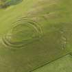
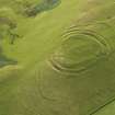
Fort and enclosure, Whiteside Hill - NT 167460: Whiteside Hill is naturally strong, the only easy approach being by way of a narrow saddle on the north east. On its summit is a fort of one acre, in which three constructural phases can be discerned, and a small enclosure of later date.
The earliest phase is represented by a rampart (1) measuring about 240ft in either direction, at best, on the SSW side, of 5ft in height externally, from the bottom of the quarry ditch. The NNE entrance (G1) is probably original, while the W entrance (G4) may also be original although it was in use in phase II. The gaps at G2 and G3 were broken through in Phases II and III respectively. The interior contains nine house-platforms which may have been constructed during the primary occupation.
In the second phase the defences were strengthened by the addition of ramparts IIA and IIB with a medial ditch. Where best preserved on the S of the fort IIA is 7ft high internally and 5ft externally. Rampart IIB is 3ft high internally and 2ft high externally.
At the N and S ends of the fort there are traces of annexes. The northern, apparently unfinished, is formed by an earthwork (D) at a distance varying from (70ft to 140ft outside in the northern arc of IIB. The earthwork consists of a slight, curved bank, accompanied for part of its length by an external quarry-ditch and pierced by a gap 17ft wide. On the S an earthwork (E) consisting of a ditch, about 15ft wide with an upcast bank on the counter scarp, leaves the SE arc of rampart IIB and expands to form an annex of crescentic shape which has a maximum width of 80ft. The earthwork has the appearance of being unfinished, but the gap between its NW extremity and the SW arc of IIB was presumably intended to be the entrance.
At some time after the multiple defences had fallen into decay the fort was re-occupied, a wall (III) being built on and partly inside rampart I. The severely robbed wall appears as a stony bank 2ft high and 18ft thick. Entrance G4 appears to have been retained at this period, but G2 was replaced by a new entrance (G3).
The defences of Phases I and II represent the normal development of a pre-Roman Iron Age fort in S Scotland, and Phase III a re-occupation after an interval of disuse which probably coincided with the Roman occupation.
The latest work on the site is an enclosure measuring 140ft by 85ft within a bank (IV) which overlies part of the wall of Phase III and impinges on one of the house platforms. The entrance is at G3.
The narrow col between Whiteside Hill and White Knowe is crossed by a linear earthwork, 45 yds long, consisting of a ditch about 15ft wide with a bank on its SW side. The earthwork is probably contemporary with the pre Roman fort. At its SE end there are the foundations of a small rectangular building of comparatively recent date.
(Information from R W Feachem notebook 1959, 119)
RCAHMS 1967, visited 1959
This fort and enclosure situated at NT 1680 4607 is as described. The linear earthwork, between Whiteside Hill and Whiteknowe is at NT 1690 4621. The ditch has a max depth of c.0.6m, the bank on the SW side has a max internal height of c.1.0m and a max external height of c.0.3m. Surveyed at 1/2500.
Visited by OS (WDJ) 31 August 1964
Description correct.
Visited by OS (JP) 7 January 1975
Photographed by the RCAHMS in 1980 (colour transparencies).
Note (12 October 2015 - 20 October 2016)
This fort occupies the N end of the broad summit area of Whiteside Hill, dominating the slope dropping down into the saddle that links the hill to the White Knowe on the ridge to the NNE. Oval on plan the fort measures 73m from NNE to SSW by 61m transversely within three ramparts with intermediate ditches forming a multivallate belt in excess of 20m deep. In drawing up a plan in 1959, however, RCAHMS investigators postulated that this belt represented two periods of construction, in which the two outer ramparts and a medial ditch were added to an originally univallate circuit comprising the inner rampart and the inner ditch. Their reasoning lay with the four entrances they identified, on the NNE, NE, E and WSW respectively, and in particular that through the inner rampart on the NNE, which appeared to be blocked by the medial rampart outside it. It should be noted, however, that this whole sector of the defences is more heavily degraded than anywhere on the rest of the circuit, including the inner rampart, which was evidently demolished in antiquity prior to the construction of a later enclosure within the interior. Thus, while their observation may be correct, the explanation may be more complex, and they do not account for why the earlier gap was left unblocked in the inner line of defence of the multivallate scheme. In their view the entrance into the multivallate fort was reconstructed a little further round on the NE, with an oblique approach that exposes the visitor's right side, matching the design of the entrance on the WSW. The entrance on the E, they contended, was inserted through the earlier defences to serve the later enclosure constructed within the interior, which also reused the WSW entrance. The perimeter of this enclosure, which has been reduced to a grass-grown bank of rubble, is set to the rear of the inner rampart on the NE and S, but clearly overlies its line on the ESE and WNW, enclosing an irregular area measuring 63m from NNE to SSW by 60m transversely (0.3ha); the SE side was subsequently adapted into the perimeter of a smaller enclosure. Within the larger enclosure there are at least ten probable crescentic scarps denoting the backs of house platforms, but it is uncertain to which phase of construction any of them belong. In addition to the core multivallate defences, there are outlying earthworks on both the N and the S that have been described as annexes, though that on the N, apparently with an entrance gap on the N, is entirely open along its W side and certainly does not form a complete enclosure. The S annexe comprises an irregular ditch with an external bank enclosing 0.14ha; it is just as likely to be the remains of an earlier hilltop enclosure, possibly unfinished, as a subsidiary enclosure of the fort. on the opposite side of the saddle to the NNE there is also a short cross-ridge-dyke, though whether it is associated with the fort is unknown.
Information from An Atlas of Hillforts of Great Britain and Ireland – 20 October 2016. Atlas of Hillforts SC3623
Sbc Note
Visibility: This is an upstanding earthwork or monument.
Information from Scottish Borders Council


