Scheduled Maintenance
Please be advised that this website will undergo scheduled maintenance on the following dates: •
Tuesday 12th November from 11:00-15:00 & Thursday 14th November from 11:00-15:00
During these times, some services may be temporarily unavailable. We apologise for any inconvenience this may cause.
Portnancon
Hut Circle (Prehistoric), Souterrain (Prehistoric)
Site Name Portnancon
Classification Hut Circle (Prehistoric), Souterrain (Prehistoric)
Alternative Name(s) An Leabaidh-fholaich; Laid; Laid Souterrain
Canmore ID 4973
Site Number NC46SW 2
NGR NC 4282 6129
Datum OSGB36 - NGR
Permalink http://canmore.org.uk/site/4973
- Council Highland
- Parish Durness
- Former Region Highland
- Former District Sutherland
- Former County Sutherland
NC46SW 2 4282 6129.
(NC 4282 6129) Earth House (NR)
OS 6"map, (1961)
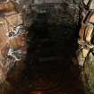
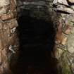
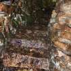
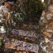
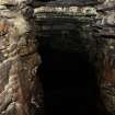
'An Leabaidh-fholaich' - the Hiding Place (Name Book 1874) - or 'An Tigh Fo Thalaidh' (OS 6"map, 2nd ed., 1908) - an apparently meaningless name, which may be for 'An Tigh Fo Thalaimh' - the House below the Ground - is a souterrain which was cleared and drained by Buxton between 1927 and 1935. The entrance was blocked by a slab 3ft 6ins long and 2ft 6ins high which now lies beside it, and the flight of twelve stone steps which led down into the gallery had been infilled by earth and stones. The gallery itself was 27ft long and 4ft 4ins to 5ft 5ins high; and the walls of undressed stone rose in an outward curve so that the width across the floor was 4ft 3ins, half-way up it was 5ft and at the roof, where it was spanned by stone lintels, it was 3ft 5ins. The end chamber was 4ft 9ins high and 5ft 7ins wide and at the NE corner was a hollow in the floor 4ft in diameter and about 2ft deep, which may have been used to drain the gallery. No relics were found but, after draining, the floor deposit yielded fragments of bone which were, however, too small for identification.
Name Book 1874; R J Buxton 1935.
The entrance passage to the souterrain measures 3m long and 0.8m wide. The gallery could not be examined as the floor is again flooded but it could be seen that the walls and roof were in good condition. A mound, 1m high, covers the souterrain.
Visited by OS (J L D) 5 April 1960.
The souterrain is as described in the preceding reports. It has been entered from within a hut circle in the SE arc but all that remains of the latter is an arc of walling extending for about 4.5m on either side of the entrance to the souterrain. The wall is overlaid by debris (presumably cleared from the souterrain) but it appears to have been about 2.0m wide, with five or six large stones on edge defining the inner face. The majority of the hut has been destroyed by the road and a ruinous field wall parallel to the road.
Revised at 1:10,000.
Visited by OS (N K B) 12 May 1980.
Publication Account (1995)
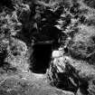
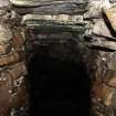
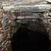
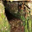
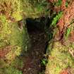
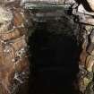
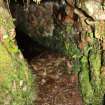
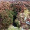
The entrance to the souterrain is marked by two small stone cairns on the east verge, but these are hidden by bracken in summer. Opposite, west of the road, is a prominent rock, and hard ground on which to park north of the burn. The souterrain once led out of a hut circle, but this has been destroyed in road works. It is quite typical of the small souterrains found in the northern Highlands: a flight of twelve stone steps leads steeply downwards into the sou errain proper, which is a curved passage some 8.5m long and up to 1.65m high and 1.5m wide. The drystone walls are built roughly into courses with larger boulders at the Dottom and the far end rounded off, the roof is Iintelled over the large slabs and the floor is of earth. Unfortunately altered drainage patterns, perhaps to do with road works, mean the souterrain is now usually flooded with water too deep for gumboots, but it is still possible to go down the steps and look along with a torch. Originally this would have been a perfectly dry storage cellar for the house above.
Information from ‘Exploring Scotland’s Heritage: The Highlands’, (1995).
Field Visit (22 February 2012)
A photographic survey was carried out at Laid (also known as Portnancon) souterrain, Durness, Highland by AOC Archaeology group in February 2012.


