
Pricing Change
New pricing for orders of material from this site will come into place shortly. Charges for supply of digital images, digitisation on demand, prints and licensing will be altered.
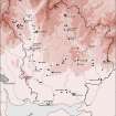
Ettrick Pen


Cairn (Prehistoric)
Site Name Ettrick Pen
Classification Cairn (Prehistoric)
Canmore ID 49711
Site Number NT10NE 1
NGR NT 19989 07637
Datum OSGB36 - NGR
Permalink http://canmore.org.uk/site/49711


- Council Dumfries And Galloway
- Parish Eskdalemuir
- Former Region Dumfries And Galloway
- Former District Annandale And Eskdale
- Former County Dumfries-shire
NT10NE 1 1998 0764.
(NT 1998 0764). Cairn (NR) (Remains of)
OS 6" map, 2nd series, (1900)
The remains of a large cairn situated on the summit of Ettrick Pen, consisting of a low irregular spread of smallish stones and measuring 30m E-W by 24m N-S and 0.5m maximum height. The perimeter is grassed over giving the appearance of a scarp but the cairn has probably been circular, the spread having occurred on the eastern,downhill side.
At the highest point, on the SW a modern cairn has been erected and on the NE is a crude modern grave consisting of piled-up stones. A headstone bears an inscription but no date is discernable.
Surveyed at 1/10560.
Plan
Visited by OS (R D L) 5 September 1962.
Situated on the summit of Ettrick Pen at over 670m OD and commanding an extensive view over the surrounding countryside, the remains comprise an irregular spread of stones measuring 29m from E to W by 24m transversely and no more than 0.4m high. This may suggest the former existence of a large cairn, but it is difficult to explain the present dilapidation since there are no stone walls nearby which could provide an explanation in terms of stone-robbing. On the highest point there is a small ruined 'shepherd's cairn' constructed with some of the stones from the larger cairn.
M J Yates 1984.
Field Visit (26 January 1994)
NT10NE 1 19989 07637
This cairn was not visited in the course of survey for the Inventory of Eastern Dumfriesshire.
Information from RCAHMS (JRS), 26 January 1994.
Listed as cairn.
RCAHMS 1997.

