
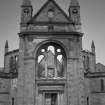
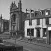
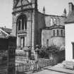
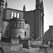
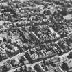
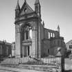
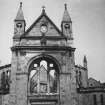
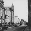
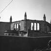
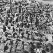
Dunfermline, Canmore Street, St Paul's Church


Church (19th Century)
Site Name Dunfermline, Canmore Street, St Paul's Church
Classification Church (19th Century)
Alternative Name(s) Abbey Free Church; Free Church; United Free Church
Canmore ID 49404
Site Number NT08NE 77
NGR NT 09196 87385
Datum OSGB36 - NGR
Permalink http://canmore.org.uk/site/49404


- Council Fife
- Parish Dunfermline
- Former Region Fife
- Former District Dunfermline
- Former County Fife
Note (6 May 2024)
A church is depicted on the 1st edition of the OS 6-inch map (1856).
Information from HES (D Watson) 6 May 2024

