Pricing Change
New pricing for orders of material from this site will come into place shortly. Charges for supply of digital images, digitisation on demand, prints and licensing will be altered.
Easton-medwin Water
Cairnfield (Period Unknown)
Site Name Easton-medwin Water
Classification Cairnfield (Period Unknown)
Canmore ID 49007
Site Number NT05SE 3
NGR NT 0902 5080
NGR Description NT 087 510 to NT 092 500
Datum OSGB36 - NGR
Permalink http://canmore.org.uk/site/49007
- Council South Lanarkshire
- Parish Dunsyre
- Former Region Strathclyde
- Former District Clydesdale
- Former County Lanarkshire
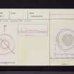
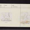
Measured Survey (1 August 1968)
Field Visit (September 1975)
NT05SE 3 087 510 to 092 500
(NT 0862 5105) Cairn (NR)
OS 6" map (1961)
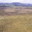
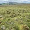
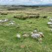
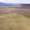
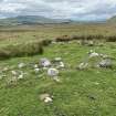
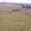
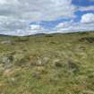
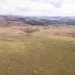
On the W side of the Medwin Water, and between heights of about 275m and 335m OD, there are more than two hundred small cairns scattered over open moorland which extends northwards from opposite Locket Gate Wood (NT 092 501) at least as far as the SE slopes of Black Law (NT 085 515). The cairns are disposed in two main sections, separated by a stretch of soft, boggy ground, and the whole area is heavily covered by peat.
(1) The bulk of the northern section is situated on the gently sloping SE flank of Cairn Knowe (NT 087 506 - NT 091 511) E of a circular stone sheepfold, but sporadic clusters occur further N, and there is a single outlier (the published cairn, NT05SE 17) situated about 20m WSW of the summit of Cairn Knowe. It measures 4.6m by 3.7m and barely 0.3m in height. The majority of the cairns are circular, measuring 3.0m in average diameter and up to 0.9m in height; thirteen are oval, measuring up to 6.7m by 4.6m, and nine are oblong, the largest as much as 8.5m by 2.4m and 0.6m in height. Immediately W of the main spread of cairns there are a number of stony banks and enclosures of no great age.
Though the term 'cairnfield' has often been employed for a concentration of small cairns such as those described above, for the purposes of the Inventory it has been thought preferable to adopt the description "groups of small cairns" in order to avoid any functional implication. The origin of these cairns has been a matter for debate, the point at issue being whether they were constructed for funerary purposes or are simply the result of field clearance. In support of the latter explanation, low stony banks, which may delimit arable plots, occur in proximity to the cairns in certain parts of Scotland, but these features are almost entirely absent in Lanarkshire and the Border counties. If the stones were the result of field clearance, in some case the building of a cairn does not seem to be the most convenient method of disposal (e.g. the marshy patch immediately adjacent to this site would have provided a more suitbale dumping-place by obviating the need for encroachment on arable ground). It should also be noted that the cairn groups under discussion do not occur in association with any known settlement sites. While the majority of the cairns are small in size, a quarter of them measure between 4.0m and 9.5m in diameter and would, if found in isolation elsewhere, be unhesitatingly be regarded as sepulchral monuments. The fact that many of the cairns contian a large proportion of earth and the presence of what appear to be equally small barrows amongst them argue against agricultural clearance. Moreover, small scale excavations at Wester Yardhouses - Hare Law (NT05SW 14) showed that while the cairns were simply heaps of stones containing no artifacts, analysis of the soil produced the high levels of phosphorus indicative of the former presence of a burial. Again, it is perhaps significant that other structures of a ritual or funerary nature sometimes occur within the clusters of small cairns (cf III).
Taking all the evidence into account, including the radiocarbon date of about 3000 BC from Chatton Sandyford, Northumberland, a date within the Neolithic period seems likely for the initial phase of these groups of small cairns in Lanarkshire. Quite apart from their numbers, there is some reason for believing that the construction of such small cairns may have continued for a considerable period of time; the excavation of a number of similar cairns at Alnham, Northumberland, revealed that one covered a cremation and an area of burning which were associated with a bronze pin dated to the 2nd century BC, but no evidence for such a late date has so far been found in Scotland.
RCAHMS 1978, September visited 1975.


