
Langloch Knowe


Sheepfold (Period Unassigned)
Site Name Langloch Knowe
Classification Sheepfold (Period Unassigned)
Alternative Name(s) Nisbet, Hut Circle
Canmore ID 48756
Site Number NT03SW 24
NGR NT 0428 3300
Datum OSGB36 - NGR
Permalink http://canmore.org.uk/site/48756


- Council South Lanarkshire
- Parish Culter
- Former Region Strathclyde
- Former District Clydesdale
- Former County Lanarkshire
NT03SW 24 0428 3300.
(NT 0428 3300) Sheepfold (NAT)
OS 6" map, (1962).
Hut Circle (NR)
OS 6" map, Lanarkshire, 2nd ed., (1912).
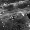
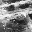
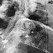
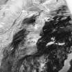
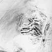
A ring enclosure is situated at the foot of the NW slope of Langloch Knowe and just above the floor of the small pass betwen Langloch Knowe and the Cow Castle ridge.
It measures 25' in diameter within a bank 9' thick and 1' high. There is a possible entrance on NW. The interior is heather-covered.
D Christison 1890; Information RCAHMS Mss notes, visited 1965.
As described. The fact that it is built on a slope with no certain entrance suggests it to be a sheepfold.
Visited by OS(DWR) 18 July 1972.
Though this enclosure is scheduled as a "hut circle", it does not appear in the RCAHMS inventory of prehistoric monuments in Lanarkshire.
Information from OS Recorder 27 June 1978; and Typescript list of Scheduled Monuments 1977 unpaged (DoE); RCAHMS 1978.

