Scheduled Maintenance
Please be advised that this website will undergo scheduled maintenance on the following dates: •
Tuesday 3rd December 11:00-15:00
During these times, some services may be temporarily unavailable. We apologise for any inconvenience this may cause.
Kilbucho, Old Parish Church And Graveyard
Burial Ground (Period Unassigned), Church (18th Century)
Site Name Kilbucho, Old Parish Church And Graveyard
Classification Burial Ground (Period Unassigned), Church (18th Century)
Canmore ID 48709
Site Number NT03SE 12
NGR NT 06538 33756
Datum OSGB36 - NGR
Permalink http://canmore.org.uk/site/48709
- Council Scottish Borders, The
- Parish Broughton, Glenholm And Kilbucho
- Former Region Borders
- Former District Tweeddale
- Former County Peebles-shire
NT03SE 12 06538 33756
For Kilbucho Manse (NT 06576 33700), see NT03SE 34.
(NT 0653 3375) Kilbucho Church (NR)
(remains of) (NAT)
OS 6" map, (1967).
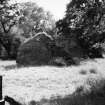
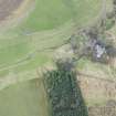
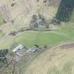
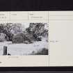
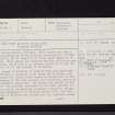
Old Parish Church, Kilbucho. This church has been a single-chambered oblong building measuring 45' 4" from E to W by 24' 2" from N to S within walls about 2' 7" thick. Both gables are complete but the side walls are reduced, the N wall to an average height of 2' and the S wall to 5'; the masonry is of rubble.
The church of Kilbucho is said to have been dedicated to St Bega, a disciple of St Aiden and St Hilda, and, although the church itself comes on record only at the beginning of the 13th century, the foundation may be of considerable antiquity. The church was rebuilt in the early 17th century, and again in the 18th century, to which period the existing fragments presumably belong. It was abandoned in or shortly before 1810, when the parish of Kilbucho was united with the combined parish of Boughton and Glenholm.
J W Buchan and H Paton eds. 1925-7; RCAHMS 1967, visited 1958.
Generally as described by RCAHMS. At the W end of the building are two slight turf banks, possibly the remains of an earlier building, or a wall attached to the W gable of the church.
Revised at 1/2500.
Visited by OS (WJ) 9 March 1964 and (DWR) 11 August 1972.
Sbc Note (15 April 2016)
Visibility: Standing structure or monument.
Information from Scottish Borders Council


