
Barnhill


Ring Ditch (Prehistoric)
Site Name Barnhill
Classification Ring Ditch (Prehistoric)
Alternative Name(s) Barnhill House; Evan Water
Canmore ID 48419
Site Number NT00SE 54
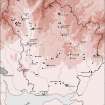
NGR NT 08592 02942
Datum OSGB36 - NGR
Permalink http://canmore.org.uk/site/48419


- Council Dumfries And Galloway
- Parish Kirkpatrick-juxta
- Former Region Dumfries And Galloway
- Former District Annandale And Eskdale
- Former County Dumfries-shire
NT00SE 54 08592 02942
A double-ditched oval enclosure measuring internally c. 16m ENE-WSW by c. 10m transversely, the distance between ditches varying from 5m to 6m, is visible on air photographs. Nothing is visible on the floodplain where it is situated.
Visited by OS, 24 November 1971
Aerial Photographic Transcription (17 October 1990 - 14 November 1990)
An aerial transcription was produced from oblique aerial photographs. Information from Historic Environment Scotland (BM) 31 March 2017.
Field Visit (July 1993)
NT 0860 0295 NT00SE 54
A double ring-ditch, measuring about 25m in overall diameter, is situated on the flood-plain of the Evan Water about 350m W of Barnhill House (NT00SE 130). It has been completely ploughed-down and no features were visible on the date of visit.
Visited by RCAHMS (JRS), July 1993.
Aerial Photographic Interpretation (20 February 1996)
NT 0860 0295 NT00SE 54
NT00SE 54 54
Aerial photography (CUCAP 1945 and 1964, and RCAHMSAP 1976) has recorded the cropmarks of a ring-ditch with a concentric outer ditch adjacent to the public road 350m W of Barnhill House (NT00SE 130). The ring-ditch measures about 12m in internal diameter and the outer ditch 22m. No entrance can be detected through either ditch.
Information from RCAHMS (SPH), 20 February 1996.
Listed as ring-ditch.
RCAHMS 1997.

