
Pricing Change
New pricing for orders of material from this site will come into place shortly. Charges for supply of digital images, digitisation on demand, prints and licensing will be altered.
Beattock, Barnhill


Fortlet (Roman)(Possible)
Site Name Beattock, Barnhill
Classification Fortlet (Roman)(Possible)
Canmore ID 48407
Site Number NT00SE 44
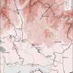
NGR NT 08512 02851
Datum OSGB36 - NGR
Permalink http://canmore.org.uk/site/48407


- Council Dumfries And Galloway
- Parish Kirkpatrick-juxta
- Former Region Dumfries And Galloway
- Former District Annandale And Eskdale
- Former County Dumfries-shire
NT00SE 44 08512 02851
The relationship of two Roman sites recorded on aerial photographs was investigated. One was a small enclosure c. 30m square, probably a Roman fortlet; the other, a marching-camp of c. 11ha (27 acres) (NT00SE 45); situated on the left bank of the Evan Water, immediately to the W of the Roman road (RR 7f). Trial excavation showed that the presumed fortlet was earlier, its ditch having been cut away by the NE angle of the camp. It was not possible to form an estimate of the interval separating the periods of use of the two structures.
G S Maxwell 1984; S S Frere 1985.
Possible fortlet of late first-century date, measuring about 33m square over a ditch 1.5m wide. Trial trenches dug 1984.
G S Maxwell and D R Wilson 1987.
Note (1997)
NT 085 028 NT00SE 44
Listed as fortlet (possible).
RCAHMS 1997.

