
Drochaid Mhor, Bridge


Road Bridge (19th Century)
Site Name Drochaid Mhor, Bridge
Classification Road Bridge (19th Century)
Alternative Name(s) Drochaid Mor; River Dionard
Canmore ID 4837
Site Number NC36SE 21
NGR NC 35987 60461
Datum OSGB36 - NGR
Permalink http://canmore.org.uk/site/4837


- Council Highland
- Parish Durness
- Former Region Highland
- Former District Sutherland
- Former County Sutherland
NC36SE 21 35987 60461
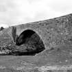
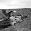
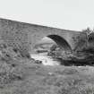
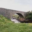
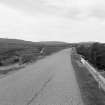
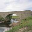
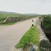
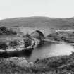
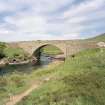
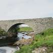
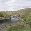
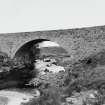
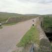
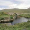
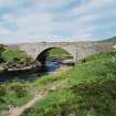
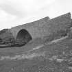
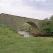
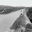
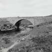
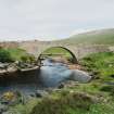
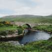
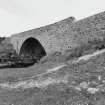
(Location cited as NC 360 604). Bridge, Drochaid Mor, c. 1834. A large single-segmental rubble arch.
J R Hume 1977.
The bridges at Rhiconich (NC25SE 7) and Drochaid Mor are very similar; both anre handsome and still in use. They have the typical vertical spandrels meeting battered abutments in a steep step at the springing and the flat parapet with quadrant ends, though these have now been run into wing walls and embanking. Both bridges were built about 1834 in beautiful places; the road at Drochaid has clearly been realigned.
G Nelson 1990.
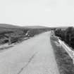
This bridge carries the A838 public road over the River Dionard.
Information from RCAHMS (RJCM), 29 April 1998.

