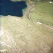
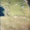
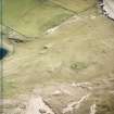
Loch Borralie South
Hut Circle(S) (Prehistoric)
Site Name Loch Borralie South
Classification Hut Circle(S) (Prehistoric)
Canmore ID 4785
Site Number NC36NE 25
NGR NC 3778 6662
Datum OSGB36 - NGR
Permalink http://canmore.org.uk/site/4785
- Council Highland
- Parish Durness
- Former Region Highland
- Former District Sutherland
- Former County Sutherland
NC36NE 25 3778 6662.
(A: NC 3773 6673) A hut circle, partially destroyed and measuring about 34 ft in diameter overall, is exposed by sand-blow on an old stabilised dune surface. Dykes and clearance cairns also occur in the blow.
(B: NC 3773 6661) A well-preserved hut, 27 ft in overall diameter.
'C', lying 18 ft NE of 'B', is a hut circle 33 ft in overall diameter.
Information from Dr C S Sandeman, Durness, 14 March 1967; R Reid 1968.
This settlement of three hut circles (A-C) centred at NC 377 667 occurs in an area of limestone ridges partially covered by dunes.
Hut 'A', at NC 3779 6676 survives as a semi-circle of rubble, 2.0m wide and 0.2m in average height, protruding through the sand and turf, with intermittent inner facing stones exposed; this represents the NW half of the hut and measures approximately 8.5m internal diameter; the SE half is presumably buried. Two transverse slabs in the W, 0.8m apart, may indicate the entrance. Scattered stones forming no obvious pattern lay in the interior.
'B' and 'C' at NC 3778 6661 and NC 3778 6662 are two similar turf-covered hut circles, having unusually slight walls spread from 1.0m to 1.5m and 0.3m high. They measure approximately 8.0m and 6.0m in internal diameter respectively. Entrances are in the SE quarter, and both have short sections of wall destroyed to the E of their entrances. Approximately 1 hectare of field clearance and presumably associated low walling lies to the SW of hut 'A' among exposed sand. The clearance heaps average 15.0m apart; many heaps have been built around living rock. Scattered fragments of iron slag occur among the sand.
Surveyed at 1:10,000.
Visited by OS (J B) 14 April 1980.


