
Seabegs


No Class (Event) (Period Unassigned), Roman Fort (Roman)(Possible)
Site Name Seabegs
Classification No Class (Event) (Period Unassigned), Roman Fort (Roman)(Possible)
Alternative Name(s) Seabegs Wood; Seabegs Pond; Seabegs Place
Canmore ID 46800
Site Number NS87NW 3
NGR NS 8172 7943
NGR Description Discovery area centred NS 8172 7943
Datum OSGB36 - NGR
Permalink http://canmore.org.uk/site/46800


- Council Falkirk
- Parish Falkirk
- Former Region Central
- Former District Falkirk
- Former County Stirlingshire
NS87NW 3 8172 7943.
See NS87NW 10
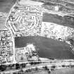
(NS 817 794) Roman Fort, Seabegs (site): Between Rough Castle and Castlecary, 3 1/2 miles W, there are no superficial indications of a fort. (RCAHMS 1963; OS field surveyor (JLD)). As this gap is nearly twice as long as the normal interval, there can be no doubt that there was an intermediate fort in the vicinity of Seabegs. The most likely position is at the E end of Seabegs Wood where some remains of fortifications are said (R Sibbald 1707) to have been visible at the end of the 17th century. Here, between the wood and Seabegs Place, is an elevated plateau, admirably adapted for the purpose, with a steep scarp to the N, a wide view in that direction and along the Wall. Horsley (J Horsley 1732), however, ignores this site and refers insted to "some ruins that possibly may be the remains of a station" at Dick's House, a village long since demolished, 1/4 mile E of Seabegs Place. The latter site is inferior, lying in a hollow, while considerations of spacing are also entirely in favour of Seabegs. (G Macdonald 1934).
RCAHMS 1963, visited 1957.
Excavations were carried out from 1968-72 under the auspices of the Hunterian Museum, and the Smith Art Gallery and Museum, Stirling, in the fields immediatly E and W of Seabegs Place farm. No trace of the presumed fort was found in either field in trenches laid at distances up to 225' S of the line of the Wall, the base of which was located.
P Briscoe and J K Thomson 1968; A S Robertson 1973.
The discovery of a fortlet (NS87NW 10) at the west end of Seabegs Wood makes it rather unlikely that a fort stood at its east end. If a fort did exist between Castlecary and Rough Castle it may perhaps be looked for further east, possibly on the farm of Milnquarter (NS 823 795).
L J F Keppie and J J Walker 1977; 1979.
In 1981, a low mound attached to the rear of the visible turf rampart of the Antonine Wall was sectioned in case it should prove to conceal, or be the remnant of, one of the turf-built expansions. There was no evidence of any structure set against the rampart at this point.
L J F Keppie and J J Walker 1990
NS 818 794. In June 1989, the 0.94ha field to the S of Seabegs Place was trenched by G B Bailey in advance of a housing development, with negative results. It was thought possible that the Military Way ran across the field.
L J F Keppie et al 1995
Field Visit (20 March 1957)
NS87NW c. 817 794 (unnoted)
Roman Fort, Seabegs (site)
Between Rough Castle and Castlecary, 3 ½ miles further west, there are no superficial indications of a fort. But as this gap is nearly twice as long as the normal interval, there can be no doubt that it was once bridged by an intermediate station situated somewhere in the vicinity of Seabegs. The most likely position for such as fort is at the east end of Seabegs Wood where some remains of fortifications are, in fact, said to have been visible at the end of the 17th century (R Sibbald 1707, 30). Here, between the wood and Seabegs Place, there is an elevated plateau which is admirably adapted for the purpose, with a steep scarp to the N, and commanding a wide view northwards across the Bonny Water and eastwards and westwards along the Wall. Horsley (J Horsley 1732, 171), on the other hand, ignores this site and refers instead to ‘some ruins that possibly may be the remains of a station’ at Dick's House, a village long since demolished, ¼ mile E of Seabegs Place. The latter site is, however, inferior from the tactical point of view since it lies in a hollow, while considerations of spacing are also entirely in favour of Seabegs (G Macdonald 1934, 239-40).
RCAHMS 1963, visited 20 March 1957.
Excavation (1968)
NS 8172 7950 Wall sectioned at three points in 1968 (Briscoe and Thomson 1968).
Field Visit (July 1977)
Seabegs NS 817 794 NS87NW 3
Probable site of the fort between Rough Castle and Castlecary.
RCAHMS 1978, visited July 1977
(Macdonald 1934, 239-40; RCAHMS 1963, pp. 102-3, No. 116; Robertson 1973, 59)

