
Watling Lodge


Fortlet (Roman), Frontier Defence (Roman)
Site Name Watling Lodge
Classification Fortlet (Roman), Frontier Defence (Roman)
Alternative Name(s) Falkirk; Tamfourhill
Canmore ID 46783
Site Number NS87NE 7
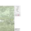
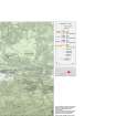
NGR NS 8625 7979
Datum OSGB36 - NGR
Permalink http://canmore.org.uk/site/46783


- Council Falkirk
- Parish Falkirk
- Former Region Central
- Former District Falkirk
- Former County Stirlingshire
NS87NE 7 8627 7978
See also NS87NE 52.
(NS 8627 7978) Roman Fortlet (R) (site of)
OS 1:1250map, (1969).
A Roman fortlet, adjoining the south side of the Antonine Wall where the road to Camelon passed through, was discovered in 1894 by M Buchanan. He uncovered parts of the east and south ramparts, these having a stone foundation about 15' broad, and also identified the gateway through the Wall. The site of the fortlet is occupied by the garden of Watling Lodge (G Macdonald 1934).
Excavations made in 1972-4 located the single outer ditch, 2.8m wide and some 1.0m deep, on the west, south, and east sides. This showed the fortlet to measure approximately 18.5m E-W by 15.5m within the rampart, the early MacDonald plan being incorrect (D J Breeze 1972; D R Wilson 1975).
D J Breeze 1975.
Plans, finds and photographs of the 1972-4 excavations are with the National Monuments Record.
DES (RCAHMS) 1979.
There is no surface trace of the fortlet (or the 1972-4 excavations) within the garden area of Watling Lodge.
Visited by OS (JRL) 25 April 1980.
In 1986, three trenches were dug over the area of the road and S defences of the fortlet.
L J F Keppie et al 1995.
(Schedule no. 8453). Scheduled as Antonine Wall, Watling Lodge fortlet.
Information from Historic Scotland, scheduling document dated 23 March 2005.
Antiquarian Observation (1894)
A Roman fortlet, adjoining the south side of the Antonine Wall where the road to Camelon passed through, was discovered in 1894 by M Buchanan. He uncovered parts of the east and south ramparts, these having a stone foundation about 15' broad, and also identified the gateway through the Wall.
Field Visit (1934)
The site of the fortlet is occupied by the garden of Watling Lodge (G Macdonald 1934).
Field Visit (29 October 1958)
NS87NE 862 798 (unnoted)
Roman Fortlet, Wading Lodge (Site).
At the villa known as Watling Lodge, roughly half-way between nthe forts at Falkirk and Rough Castle,a gap in the Antonine Wall gave passage to the main Roman road that led to Camelon and beyond. Protecting the gap there was a small fort or block-house which was discovered in 1894 but is now completely buried beneath the garden of the villa. It was attached to the S. side of the Antonine Rampart, and appears to have measured about 130 ft. from E. to W. by about 100 ft. from N. to S. within a rampart which had a stone foundation some 15ft. in thickness (1). Similar fortlets have since been found elsewhere on the Wall, and it may well be that the series extended, at regular intervals, for the whole length of the barrier (RCAHMS 1963, Introduction, p. 34).
RCAHMS 1963, visited 29 October 1958.
(1) RWS, 344-5 and fig. 51.
Aerial Photography (1971)
Excavation (1972 - 1974)
NS87NE 7 8627 7978
A Roman fortlet, adjoining the south side of the Antonine Wall where the road to Camelon passed through, was discovered in 1894 by M Buchanan. He uncovered parts of the east and south ramparts, these having a stone foundation about 15' broad, and also identified the gateway through the Wall. The site of the fortlet is occupied by the garden of Watling Lodge (G Macdonald 1934).
Excavations made in 1972-4 located the single outer ditch, 2.8m wide and some 1.0m deep, on the west, south, and east sides. This showed the fortlet to measure approximately 18.5m E-W by 15.5m within the rampart, the early MacDonald plan being incorrect (D J Breeze 1972; D R Wilson 1975).
D J Breeze 1975.
Plans, finds and photographs of the 1972-4 excavations are with the National Monuments Record.
DES (RCAHMS) 1979.
Photographic Record (1976)
Note (1978)
Watling Lodge NS 862 797 NS87NE 7
Listed as a fortlet.
(Christison and Buchanan 1901, 337; Macdonald 1934, 344-6; Robertson 1973, 29, 54; Breeze 1974)
Field Visit (25 April 1980)
There is no surface trace of the fortlet (or the 1972-4 excavations) within the garden area of Watling Lodge.
Visited by OS (JRL) 25 April 1980.
Excavation (1986)
'Watling Lodge (Falkirk p). Roman fortlet. Excavation in advance of roadworks.
Bailey, Geoffrey B
Publication Account (1995)
In 1986, three trenches were dug over the area of the road and S defences of the fortlet.
L J F Keppie et al 1995.
Publication Account (2008)
A 1:25000 scale map of the Antonine Wall was published by RCAHMS in 2008. The map shows the course of the Antonine Wall on a modern map base, including areas where the Wall is in public ownership or care and can be visited. The data had been collated as part of the project to prepare maps for the World Heritage Site nomination bid.
Excavation (August 2014)
NS 8623 7977 In August 2014 local children excavated a trench on the line of the Roman road issuing from the S gate of the fortlet at Watling Lodge on land adjacent to Tamfourhill Community Centre. Plough marks on the natural clay showed that any Roman features would have been removed by
agricultural activity. At the W end of the trench machine scoops were associated with the creation of the play park in the 1970s.
Funder: Falkirk Community Trust and Tamfourhill Community Centre
Geoff Bailey
(Source: DES)

