
Following the launch of trove.scot in February 2025 we are now planning the retiral of some of our webservices. Canmore will be switched off on 24th June 2025. Information about the closure can be found on the HES website: Retiral of HES web services | Historic Environment Scotland
Stonebyres


Country House (Period Unassigned), Tower House (Medieval)
Site Name Stonebyres
Classification Country House (Period Unassigned), Tower House (Medieval)
Canmore ID 46661
Site Number NS84SW 11
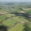
NGR NS 84131 43860
Datum OSGB36 - NGR
Permalink http://canmore.org.uk/site/46661


- Council South Lanarkshire
- Parish Lesmahagow
- Former Region Strathclyde
- Former District Clydesdale
- Former County Lanarkshire
NS84SW 11 84131 43860
(NS 8413 4386) Stonebyres (NR)
OS 6" map (1940-1)
Stonebyres was in existence in the 15th century and, prior to 1850, when the present mansion encasing the old structure was erected, consisted of the original keep, 34 feet by 29 feet, with an addition at one end making it an oblong tower approximately 70 feet by 34 feet, five stories high.
D MacGibbon and T Ross 1887
The mansion is being demolished.
Visited by OS (JFC) 11 March 1954
The walls of the Tower can still be seen; they are approximately 0.3m high.
Information from OS Reviser (T H Dick) 20 December 1962
NMRS REFERENCE:
Architect: John Baird (Primus) - extensive additions. D. Hamilton worked there 1840
Demolished: 1934
The estate was sold to Messrs. Kennoway & Fraser, Estate Agents, 9 South Charlotte Street, Edinburgh,
who then resold it to the Department of Agriculture reserving the house for demolition.
The modern additions are of two periods, c.1850, 1907-14;
the old house is probably of two periods also, including a 15th centrury tower.
Photographic Survey (1934)
Photographic survey likely by the Ministry of Works in 1934.

