
Following the launch of trove.scot in February 2025 we are now planning the retiral of some of our webservices. Canmore will be switched off on 24th June 2025. Information about the closure can be found on the HES website: Retiral of HES web services | Historic Environment Scotland
Unst, Burragarth


Standing Stone (Prehistoric)
Site Name Unst, Burragarth
Classification Standing Stone (Prehistoric)
Canmore ID 46
Site Number HP50SE 26
NGR HP 5754 0395
Datum OSGB36 - NGR
Permalink http://canmore.org.uk/site/46


- Council Shetland Islands
- Parish Unst
- Former Region Shetland Islands Area
- Former District Shetland
- Former County Shetland
HP50SE 26 5754 0395
(HP 5754 0397) Standing Stone (NR).
OS 6" map, Shetland, 2nd ed., (1900).
See also HP50SE 9.
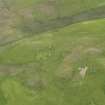
A rough quadrangular boulder with no clear evidence of packing at base. It stands 3' high and has a girth of 7' at base. It is locally supposed to have been a boundary stone.
OS Name Book 1878; RCAHMS 1946, visited 1930.
As described by the RCAHMS: almost certainly a boundary stone.
Visited by OS (NKB), 5 May 1969.
Using the 4m high standing stone described on HP50SE 9 as backsight, this 1m high standing stone at a distance of 0.7km to the NNW, acts as skyline foresight for a hitherto unnoticed lunar alignment with declination 28'.629.
H Exton 1994b.

