Pricing Change
New pricing for orders of material from this site will come into place shortly. Charges for supply of digital images, digitisation on demand, prints and licensing will be altered.
Chapelhall, St Lasrach Chapel
Chapel (Period Unassigned), Coffin(S) (Period Unassigned)
Site Name Chapelhall, St Lasrach Chapel
Classification Chapel (Period Unassigned), Coffin(S) (Period Unassigned)
Canmore ID 45790
Site Number NS76SE 8
NGR NS 7850 6322
Datum OSGB36 - NGR
Permalink http://canmore.org.uk/site/45790
- Council North Lanarkshire
- Parish Bothwell (Motherwell)
- Former Region Strathclyde
- Former District Motherwell
- Former County Lanarkshire
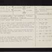
NS76SE 8 7850 6322.
(NS 7842 6321) Chapel (NR) (site of)
OS 6" map (1967)
The ruins of this chapel dedicated to St Lasrach (H Scott 1920) were used as a burial place by the Lanchope family at the beginning of the 18th century. Though no trace remained in 1858, the site was still well known, ruins still standing in the early 19th century.
Seven wooden coffins, containing decayed skeletons, were found nearby about 1840 when making a cutting for a road to the iron works.
OPS 1851; H Scott 1950; Name Book 1858
The site of this chapel is covered by slag heaps, and no trace of it exists. The siting symbol was obtained from a map by Coatbridge Town Planning Office, in Coatbridge Public Library (scale 2 1/2": 1 ml).
Visited by OS (JLD) 23 October 1952
The chapel is depicted at NS 7850 6322 on the 6-inch 2nd edition OS map (Lanarkshire 1864, sheet viii.SE). It is also marked on the 1st edition OS map (Lanarkshire 1864, sheet viii) at the same general location. By the 1913 edition 6-inch OS map (Lanarkshire 1913, sheet viii.SE) the site had been lost beneath extensive spoil heaps though the description survived, being annotated to the W. Erroneously the location of the site became identifed with this text.
Recorded by RCAHMS (PMcK) 25 May 1993


