Broich Burn, New Mill
Grain Mill(S) (Period Unassigned)
Site Name Broich Burn, New Mill
Classification Grain Mill(S) (Period Unassigned)
Canmore ID 45410
Site Number NS69SW 8
NGR NS 6307 9333
Datum OSGB36 - NGR
Permalink http://canmore.org.uk/site/45410
- Council Stirling
- Parish Kippen
- Former Region Central
- Former District Stirling
- Former County Stirlingshire
NS69SW 8 6307 9333
(NS 6307 9333) New Mill (In ruins) (NAT).
OS 6" map (1958)
The ruins of the New Mill, a small corn mill burnt down in 1856 (Name Book 1860) stand on the Broich Burn. The date 1774 appears on a lintel of the mill-house and the whole structure appears to be contemporary (RCAHMS MS notes 1957).
Traditionally a 'new mill' was built here in the reign of James V (OSA 1796) or VI (Name Book 1860) and the existence of two mill-lades and two mill-ponds, the westernmost system being aligned with the present ruins and appearing to encroach on the other, suggest that an earlier mill may have stood just east of the present site.
RCAHMS MS notes 1957
The walls of this mill, 0.6m thick and 2.0m high in average, are of red-sandstone blocks and appear to be contemporary with the date-stone 1779 (not 1774). Indeterminate remains to the east may indicate the site of an earlier mill while to the SSE can be seen two large mill-ponds (now dry).
Visited by OS (WDJ) 20 September 1968
Two unroofed buildings which are annotated as Ruins and named New Mill are depicted on the 1st edition of the OS 6-inch map (Stirlingshire 1865-6, sheet xv). One unroofed building is shown on the current edition of the OS 1:10000 map (1979).
Information from RCAHMS (SAH) 2 February 1998
NS69SW 8 6307 9333
see also archaeology notes.
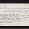
New Mill, Kippen, c. 1800
Description: ?2 storey stone building, built predominantly of reddish sandstone. Waterwheel on W end of mill.
Condition: In ruins; W wall stands complete but only wall bases remain of other walls; wheelshaft in situ; otherwise gutted.
Wheel: Apparently external wheel on the W end of mill; presumably overshot, approximately 13 feet [in diameter] by 3 feet 6 inches [in width]. Iron wheelshaft in situ.
Danger of Damage/Demolition: Likely to collapse.
Drive System: No evidence other than that drive was by pit-wheel.
Mill Machinery: No evidence.
Remarks: No millstones or other evidence found.
Visited and photographed by Alan Stoyel, Doune, Perthshire, Society for the Preservation of Ancient Buildings Wind and Watermill Section Watermill Record Card (copy), 2 October 1970.
Information from NMRS MS/749/109.


