Pricing Change
New pricing for orders of material from this site will come into place shortly. Charges for supply of digital images, digitisation on demand, prints and licensing will be altered.
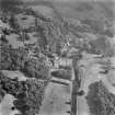
Glasgow, Pollokshaws Road, Pollok Park, Old Pollok House
Castle (Medieval), Dovecot (Period Unassigned), Gateway (Period Unassigned), House (Period Unassigned), Well (Period Unassigned)
Site Name Glasgow, Pollokshaws Road, Pollok Park, Old Pollok House
Classification Castle (Medieval), Dovecot (Period Unassigned), Gateway (Period Unassigned), House (Period Unassigned), Well (Period Unassigned)
Alternative Name(s) Pollok House; Pollok Estate; Nether Pollock
Canmore ID 44308
Site Number NS56SE 46
NGR NS 55032 61645
NGR Description NS c.5504 6164
Datum OSGB36 - NGR
Permalink http://canmore.org.uk/site/44308
- Council Glasgow, City Of
- Parish Eastwood (City Of Glasgow)
- Former Region Strathclyde
- Former District City Of Glasgow
- Former County Lanarkshire
POLLOK ESTATE
The lands of Nether Pollok were the property of the Maxwell family from the 13th century. The original castle was built by Sir John Maxwell of Pollok, the second castle was inhabited until the mid-16th century, and the third was built in 1367. Sir John Maxwell, third baronet, started the present Mansion in 1747, completing it in 1752. In 1939 Sir John Stirling-Maxwell drew up a conservation agreement over the estate with the National Trust for Scotland, of which he was a founder member. His daughter gifted the house and estate to the City in 1966, with permission to build the Burrell Gallery in the grounds.
Pollok House, 1752, possibly Allan Dreghorn
Large mid-Georgian mansion with Gibbsian baroque details; hipped bellcast slate roof, swags beside upper windows. Original house raised over semibasement, plain elevations, rustic corner and keystoned lintels at ground and first floors. Projecting pedimented centrepiece to forecourt. Plain rear façade, wide central Venetian staircase window. High-quality internal decorative plasterwork and period furnishings; wonderful library. Low wings and ogee-roofed garden pavilions added, 1890 onwards, R Rowand Anderson. Important collections of Spanish paintings and six William Blake watercolours. Glasgow City Council, managed by National Trust for Scotland, open to the public, guide book
Lodge, Pollok House, 97 Haggs Road, 1892, R Rowand Anderson. Scottish classical with shallow conical slate roof over a broad semicircular bay window. Shawmuir Lodge, Pollok Avenue, 2060 Pollokshaws Road, 1891, Robert Rowand Anderson. Scots Classical Lodge with bell-cast slate hipped roof. Tall square gatepiers with urns and decorative wrought-iron gates. Estate Bridge over River Cart, 1757. Single wide segmental arch, balustraded parapet, roadway widens at abutments. Stables Range, 17th to 19th century. Courtyard Range on site of previous house, the Laigh Castle, includes handsome Renaissance gateway (north-west side) and more 17th-century work incorporated into later buildings. Weir, Sawmill and Power Station, c.1860 for Sir John Stirling-Maxwell. Weir may be 18th century. Single-storey brick sawmill with early machinery, although a turbine replaces the low-breast water wheel. Late 19th-century Power Station, with Waverley turbine by Carrick & Ritchie of Edinburgh.
Taken from "Greater Glasgow: An Illustrated Architectural Guide", by Sam Small, 2008. Published by the Rutland Press http://www.rias.org.uk
NS56SE 46 5504 6164
NS56SW 31.00 54867 61850 Pollok House
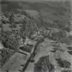
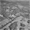
Pollok has belonged to the Maxwell family since the later 13th century The present mansion (at NS 54867 61850) was finished in 1752, but a small portion of its 14th century predecessor and a fine 17th century gateway are incorporated in the stable block to the E.
R G Cant and I G Lindsay 1947; Information from revision Name Book 1934, 9.
Pollok House itself is not an antiquity, but the remains of its predecessor were located at NS 5504 6164 ('A'). This is simply a fragment of an old wall 3.0m in height and some 6.0m long, forming part of the rear wall of the stable block. The wall is composed of rough-dressed squared masonry, and in it is a small embrasured window. The 17th century gateway ('B') is at NS 5500 6166. This is of simple construction and is of no great interest. It forms a barrel-vault archway to the stable courtyard and has a cavity for a (?) portcullis. At NS 5500 6168 ('C'), in an old garden wall, is a recessed well-head which is now dry. It is uninscribed and undecorated, but appears old and may well be contemporary with the 17th century gateway.
To the SW, at NS 5494 6158, are the remains of a 17th century rectangular dovecot.
No further information was found during field investigation.
Visited by OS (J L D) 1 April 1954.
It seems that there were three castles of Nether Pollok built on the same site, the last being used as the dower house for a previous one until replaced by Haggs Castle (NS56SE 41) It then became the principal residence until it was in turn pulled down and replaced almost on the same site by Pollok House (the present mansion). An 18th century writer, visiting the last castle of Nether Pollok, says, "Upon an eminence near to this stood the old Castle of Pollok. . . where there are still the remains of a drawbridge and a fossy." (cf NS56SE 33 & 59). All traces of these castles have gone, although it is said that part of the last one can be seen in a garden wall of Pollok House.
P McDonald 1979.
NS 5500 6160 During cable-laying works at the southern end of the E range of the former stable block E of Pollok House, the sandstone capping of a well was broken. Glasgow Museums informed the Strathclyde Joint Archaeology Service, who carried out a recording visit. The well-shaft was not safely accessible, but was oval on plan and measured approximately 0.6m by 0.9m. It was dry when uncovered, and silted up to within 1.5m of the underside of the capstone, which was 0.15-0.2m thick and sealed by approximately 0.2m of modern make-up. The shaft was constructed of unbonded hand-made bricks and a lead pipe was let into the shaft from the N side, presumably a pump drawpipe for the building to the N. No well is marked on maps of the area from the 1st Edition OS (c1860) onwards. The well was recapped and the cable trench re-routed to the S of it.
Sponsor: Strathclyde Joint Archaeology Service.
Strathclyde Regional Council SMR 1995.


