
Following the launch of trove.scot in February 2025 we are now planning the retiral of some of our webservices. Canmore will be switched off on 24th June 2025. Information about the closure can be found on the HES website: Retiral of HES web services | Historic Environment Scotland
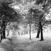
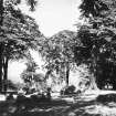
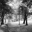
Glasgow, Queen's Park, Camphill


Earthwork (Period Unassigned)
Site Name Glasgow, Queen's Park, Camphill
Classification Earthwork (Period Unassigned)
Canmore ID 44292
Site Number NS56SE 32
NGR NS 5776 6211
Datum OSGB36 - NGR
Permalink http://canmore.org.uk/site/44292


- Council Glasgow, City Of
- Parish Cathcart (City Of Glasgow)
- Former Region Strathclyde
- Former District City Of Glasgow
- Former County Lanarkshire
5776 6211.
(NS 5776 6211) Earthwork (NR)
OS 6" map, (1967)
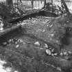
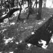
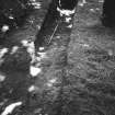
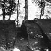
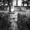
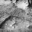
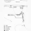
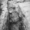
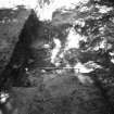
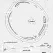
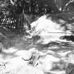
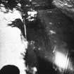
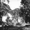
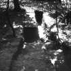
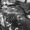
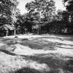
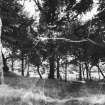
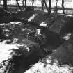
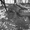
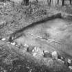
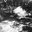
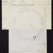
The earthwork at Camphill measures overall 130 yds (119m) NW-SE by 109 yds (98m); it does not encircle the actual summit of the hill, but runs over the highest part, and then curves down and around the shoulder on the WNW side; perhaps the difficulty of drainage on the summit clay was avoided by this location. The rampart is badly eroded, and the construction of a park road on its outer side has obliterated all signs of a ditch. The highest parts of the rampart are the E and SE sectors, where it stands 4' -6' above the interior, 7' - 8' high externally, and is 25' - 30' wide overall. A 22' wide gap in the SE formed an entrance, but another hollow in the E rampart is best explained as an excavation, possibly that of 1867 (infra). Another hollow, 50 yds W of the entrance and 25' wide is suggestive of another entrance. In the SW, the rampart continues as a scarp; a gap on the W, 45', is difficult to explain - possibly the site of a water tank. The N sector of the earthwork is an ill-marked scarp, disappearing in places. No signs of foundations were detected within the enclosure. In the centre, however, some three dozen boulders form an irregular group over a space some 60' wide. They were probably for some 19th century ornamental purpose.
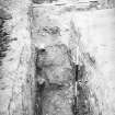
Excavations in 1867 revealed a "sort of paved floor" near the centre of the enclosure, at a depth of about 8'. Over the surface lay a cake of charred oats mixed with fragments of oak (samples are in the People's Palace Museum, Glasgow). This was thought to be a grain-drying kiln (information from the Glasgow Herald, 15 July 1867).
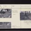
Further excavations were carried out by Fairhurst and Scott in July and September 1951. They recovered sherds of pottery "not later than 14th century" from the very bottom of the ditch. They give a full excavation report (Fairhurst and Scott 1953) and conclude that the earthwork is best described as a "clay castle".
H Fairhurst and J G Scott 1953; Visited by OS (W M J) 21 July 1951.
The remains of this earthwork are as described above.
Visited by OS (J L D) 1 April 1954.
Talbot compares this site with others in the vicinity (NS46SE 3, NS56SW 4, and NS56SE 33) and suggests that it was a Norman ringwork earth and timber castle.
E J Talbot 1973.
This site was visited in the course of fieldwork by Dr. T.C. Welsh in 1999.
For further information see MS/1328

