
Following the launch of trove.scot in February 2025 we are now planning the retiral of some of our webservices. Canmore will be switched off on 24th June 2025. Information about the closure can be found on the HES website: Retiral of HES web services | Historic Environment Scotland
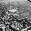
Glasgow, High Street And Ingram Street


Building(S) (Period Unassigned)
Site Name Glasgow, High Street And Ingram Street
Classification Building(S) (Period Unassigned)
Canmore ID 44024
Site Number NS56NE 113
NGR NS 598 651
Datum OSGB36 - NGR
Permalink http://canmore.org.uk/site/44024


- Council Glasgow, City Of
- Parish Glasgow (City Of Glasgow)
- Former Region Strathclyde
- Former District City Of Glasgow
- Former County Lanarkshire
NS56NE 113 598 651
Two cuts were made parallel to High Street, and a few feet from it, a little to the south of the junction with Ingram Street. Greyfriars Wynd was sectioned but was found to be heavily disturbed. Foundations of buildings, with documentation going back to 1599 were located. They incorporated chamfered blocks possibly robbed from the site of the Blackfriar's across the road after the Reformation. Only modern finds were made. The natural clay appeared at 10" to 2' 4" beneath the surface.
E Talbot 1969.

