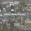
Newmilns, Castle Street, Newmilns Tower, Ducat Tower
Tower House (Medieval)
Site Name Newmilns, Castle Street, Newmilns Tower, Ducat Tower
Classification Tower House (Medieval)
Alternative Name(s) Newmilns Castle
Canmore ID 43682
Site Number NS53NW 12
NGR NS 53643 37355
Datum OSGB36 - NGR
Permalink http://canmore.org.uk/site/43682
- Council East Ayrshire
- Parish Loudoun
- Former Region Strathclyde
- Former District Kilmarnock And Loudoun
- Former County Ayrshire
NS53NW 12 53643 37355
(NS 5364 3735) Twr (NR)
OS 6" map (1968)
Newmilns Tower, now an adjunct to an inn, is a simple 16th century tower measuring 30ft by 24ft over walls 5ft in thickness. Rubble-built, it has three storeys beneath the parapet and an attic storey above. The roof has been altered and lowered. The entrance is at ground level the basement is vaulted, and a wheel-stair rises in the SE angle.
D MacGibbon and T Ross 1889; N Tranter 1965
Newmilns Tower is as described.
Visited by OS (JLD) 21 August 1956
As described, and in a generally neglected condition. Unoccupied. According to local information, the tower has recently been purchased with a view to renovation.
Visited by OS (JRL) 30 July 1982
Observations of contractors excavations connected with the restoration of this tower house were undertaken in two phases. The machine excavation of ground to the N and E of the tower revealed that it had very shallow foundations and located the exit point for the garderobe chute. Monitoring of new service trenches through the front door of the tower located natural clay c. 0.15m below modern ground level. Parts of the cobbled surface of the earlier version of Castle Street were located running past the tower on its eastern side.
Sponsor: Ian Cumming (developer)
D Hall and A Bailey 1993.
NMRS REFERENCE:
16th Century
EXTERNAL REFERENCE:
National Trust Survey Lists nos: 1 and 2 showing Loudon Arms.


