
Scheduled Maintenance
Please be advised that this website will undergo scheduled maintenance on the following dates: •
Tuesday 12th November from 11:00-15:00 & Thursday 14th November from 11:00-15:00
During these times, some services may be temporarily unavailable. We apologise for any inconvenience this may cause.
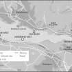
Langbank East, River Clyde


Causeway (Prehistoric)(Possible), Crannog (Prehistoric)
Site Name Langbank East, River Clyde
Classification Causeway (Prehistoric)(Possible), Crannog (Prehistoric)
Alternative Name(s) Langbank East Crannog; Fornet Cottage
Canmore ID 43351
Site Number NS47SW 29
NGR NS 40497 73171
Datum OSGB36 - NGR
Permalink http://canmore.org.uk/site/43351


- Council Renfrewshire
- Parish Erskine
- Former Region Strathclyde
- Former District Renfrew
- Former County Renfrewshire
NS47SW 29 4050 7328
Not to be confused with:
NS37SE 9 NS 3813 7355 Langbank West Crannog, or
NS47SW 22 NS 4355 7283 Langbank Crannog ('Baby Island')
(NS 4050 7328) Langbank East Crannog: Shows clearly on air photographs with a causeway leading from it to the mainland on the E side. Piles can sometimes be seen protruding through the sand.
Information from Mr J Hunter (Paisley Museum), 3 November 1972.
NS 4050 7328 A low mound of stones forming a substantial irregular scatter, orientated NW?SE. The highest point consists of a roughly rectangular stone feature. Amongst the stone scatter on the N side of the site are a number of possible features which appear as circular or sub-rectangular stone-edged pools and even at low tide hold water. The site is c 100m from HWM and between the site and the present shoreline are two distinct parallel lines of stones. These appear to delineate a possible trackway to the site, rather than a causeway to the shoreline.
Sponsors: Society of Antiquaries of Scotland, Wingate Foundation
A G C Hale 1997.
Scheduled as 'Fornet Cottage, crannog 290m N of... the remains of a marine crannog and a possible causeway... on the intertidal flats approximately 290m N of Fornet Cottage and 95m N of the high water line.'
Information from Historic Scotland, scheduling document dated 11 February 2011.
The cited location remains unverified, but the crannog is evidently situated about 200m off the Southern bank of the River Clyde, opposite Fornet Cottage (NS47SW 161). This location falls within the intertidal zone and behind (to the S of) the line of the Southern river training wall.
Information from RCAHMS (RJCM), 22 March 2011.
Note (12 May 2016)
This crannog is visible on vertical aerial photography as a roughly oval mound of stones, measuring about 42m from NW to SE by 37m transversely, standing within the inter-tidal zone 90m from the southern bank of the River Clyde. Two stony banks, up to 10m apart and which extend from the SE edge of the mound for distances up to 56m towards the bank, are also visible on the imagery.
Information from HES Survey and Recording (JRS) 12 May 2016.

