
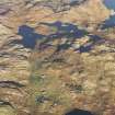
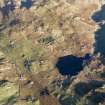
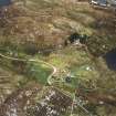
Lewis, Calbost


Head Dyke (Post Medieval), Township (Period Unassigned)
Site Name Lewis, Calbost
Classification Head Dyke (Post Medieval), Township (Period Unassigned)
Canmore ID 4290
Site Number NB41NW 1
NGR NB 4140 1730
NGR Description Centred NB 4140 1730
Datum OSGB36 - NGR
Permalink http://canmore.org.uk/site/4290


- Council Western Isles
- Parish Lochs
- Former Region Western Isles Islands Area
- Former District Western Isles
- Former County Ross And Cromarty
NB41NW 1.00 centred on 4140 1730
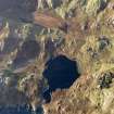
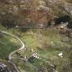
NB41NW 1.01 NB 4143 1709 Horizontal Mill
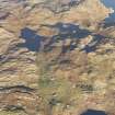
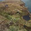
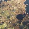
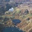
A township comprising ninteen roofed, one partially roofed, four unroofed buildings, two of which are annotated as Ruins, five enclosures and a head-dyke is depicted on the 1st edition of the OS 6-inch map (Ross-shire, Island of Lewis 1854, sheet 38). One of the roofed and one of the unroofed buildings are annotated as Corn Mills.
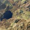
Fifteen roofed, four partially roofed, thirty-four unroofed buildings and the fragmentary remains of the head-dyke are shown on the current edition of the OS 1:10000 map (1974).
Information From RCAHMS (SAH) 9 July 1997

