
Auchencloigh Castle


Castle (Medieval)
Site Name Auchencloigh Castle
Classification Castle (Medieval)
Alternative Name(s) Auchincloigh Castle
Canmore ID 42644
Site Number NS41NE 1
NGR NS 49448 16663
Datum OSGB36 - NGR
Permalink http://canmore.org.uk/site/42644


- Council East Ayrshire
- Parish Ochiltree
- Former Region Strathclyde
- Former District Cumnock And Doon Valley
- Former County Ayrshire
NS41NE 1 49448 16663
(NS 4945 1666) Auchincloigh Castle (NR) (In Ruins)
OS 6" map (1908)
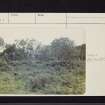
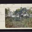
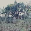
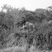
All that remains of this is a broken and irregular mass of stone and lime. This has once been a rectangular building of great strength; its walls are from 2' - 5' high and about 5' thick.
Name Book 1855
The remains consist of a tumbled mass of rubble whinstone, lime-bonded. The rectangular structure measured 12.0m x 10.5m, the walls being 1.4m thick. Although no dating evidence was discovered, the type of masonry and thickness of the walls indicate an early date for this tower. Nothing is known of the history of this castle (M Howat, Auchincloigh Farm).
Visited by OS (JFC) 18 June 1954
The spelling of the above is now "Auchencloigh". The farm name is now changed to the new spelling (notice board). The name was also confirmed verbally.
Visited by OS Reviser 27 August 1959
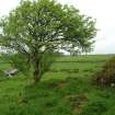
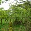
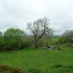
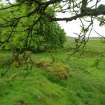
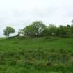
Auchincloigh (now Auchencloigh) Castle: Some of its walls are still standing and are between 0.6 and 1.6m in height and in some places several feet in thickness. These walls form a rectangule and the interior seems to be subdivided into several small rooms. The castle stands on a mound and fallen rubble lies all around.
J Retter 1978
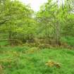
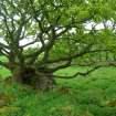
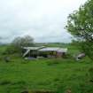
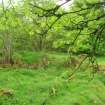
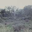
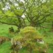
The remains of the castle are scrub-covered and a stone-walled sheepfold has been built into the SW side.
Visited by OS (MJF) 2 October 1980
Site recorded during a desk-based and field inspection by CFA within the accessible areas of a proposed opencast coal extraction site.
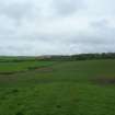
NS 4944 1666 Auchencloigh Castle (outside site boundary)
A report will be deposited in the NMRS. The advice and assistance of the Regional Archaeologist for Strathclyde Region is gratefully acknowledged.
Sponsor: Natural Resource Consultancy, Ayr.
W L Finlayson and D Alexander 1995.
Field Walking (July 2007 - July 2008)
CFA produced an annex for the Environmental Statement considering the likely effects of the South West Scotland Project (the SWS Project) on cultural heritage assets.
Reconnaissance field survey, comprising non-intrusive walkover surveys, was conducted within the narrow corridor study areas for each connection comprising the SWS Project. The survey work was undertaken between July 2007 and July 2008.
Areas of dense commercial forestry and active opencast coal mining were not surveyed in detail due to access difficulties and restrictions, and the baseline conditions of features identified within these areas during the desk-based studies were not established. Any uncertainty as a consequence of this has been acknowledged in the assessments.
Identified sites were recorded on pro-forma monument recording forms, including a sketch plan where applicable, and by digital photography, and were located using GPS readings. These archive materials will be offered to bodies holding the relevant Sites and Monuments Records.
Scottish Power
CFA Archaeology

