Pricing Change
New pricing for orders of material from this site will come into place shortly. Charges for supply of digital images, digitisation on demand, prints and licensing will be altered.
Cardross, Main Road, Former Parish Church
Burial Ground (17th Century), Church (19th Century)
Site Name Cardross, Main Road, Former Parish Church
Classification Burial Ground (17th Century), Church (19th Century)
Canmore ID 42386
Site Number NS37NW 3
NGR NS 34930 77284
Datum OSGB36 - NGR
Permalink http://canmore.org.uk/site/42386
- Council Argyll And Bute
- Parish Cardross (Argyll And Bute)
- Former Region Strathclyde
- Former District Dumbarton
- Former County Dunbartonshire
NS37NW 3 3493 7728
For Cardross, Old Parish Church (NS 3935 7500), see NS37NE 11. For present parish church of Cardross (NS 3445 7753), see NS37NW 29.
(NS 3493 7728) Church (NAT)
OS 6" map (1923)
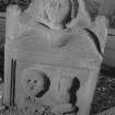
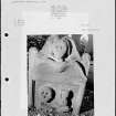
In 1643 the parish church of Cardross was moved to its present position, where it was replaced by the present building in 1826. There are no remains of the 17th century church to be seen, and the 19th century church is now a ruin. The graveyard is still in use and contains several 17th century gravestones.
Visited by OS (RDL) 18 January 1963.
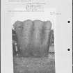
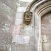
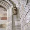
Old Parish Church, 1826-7, James Dempster. The first church on this site was erected in 1643-4 after the parish boundaries had been redrawn and the centre of the parish moved from Levengrove Park, Dumbarton. In 1826 a second church was commissioned. A battlemented and long-pinnacled tower with its bracing gable, each diagonally buttressed, are all that remain of Dempster's Perpendicular Gothic. Bombed in 1941, the church was razed in 1954 to an elevated lawn at sill height, a commemmorative strategy that has proved wholly successful. More personal memorials are gathered in its shadow, including two identical mausoleum enclosures, castellated and gunlooped, on the western margin of the burial plot.
F A Walker and F Sinclair 1992.


