Pricing Change
New pricing for orders of material from this site will come into place shortly. Charges for supply of digital images, digitisation on demand, prints and licensing will be altered.
Hessilhead Castle
Tower House (Medieval)
Site Name Hessilhead Castle
Classification Tower House (Medieval)
Alternative Name(s) Hasslehead; Hazelhead; Hesselheid
Canmore ID 42202
Site Number NS35SE 6
NGR NS 38013 53297
Datum OSGB36 - NGR
Permalink http://canmore.org.uk/site/42202
- Council North Ayrshire
- Parish Beith (Cunninghame)
- Former Region Strathclyde
- Former District Cunninghame
- Former County Ayrshire
NS35SE 6 38013 53297
Hessilhead Castle (NR) (In Ruins)
OS 6" map (1911).
(NS 3801 5330) Hessilhead Castle (NR) (site of)
OS 6" map (1970).
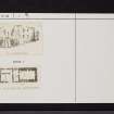
Hessilhead Castle, now roofless and ruinous, is an oblong structure, built at two periods, measuring some 74 feet by 38 1/2 feet. The old (W) part was apparently a 15th-17th century keep; the E addition was build by Francis Montgomerie, who bought the estate in 1680. Both old and new parts are vaulted on the ground floor; the upper parts are too ruinous to describe. The mansion was allowed to become ruinous about 1776. It was noted by Pont as a strong old building, surrounded with large ditches and situated on a loch.
D MacGibbon and T Ross 1889.
Hessilhead Castle has been demolished. Extensive quarrying around the site has removed any possible traces of a moat. No building vestiges remain.
Visited by OS (DS), 28 August 1956.


