 |
On-line Digital Images |
SC 488485 |
Papers of Professor John R Hume, economic and industrial historian, Glasgow, Scotland |
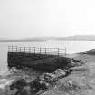
Callanish, Pier
View from NE |
25/4/1976 |
Item Level |
|
 |
On-line Digital Images |
SC 488486 |
Papers of Professor John R Hume, economic and industrial historian, Glasgow, Scotland |
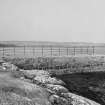
Callanish, Pier
View from SW |
25/4/1976 |
Item Level |
|
 |
On-line Digital Images |
SC 1692209 |
RCAHMS Aerial Photography |
General oblique aerial view centred on the research centre, stone circle and stone alignments with the township adjacent, taken from the SW. |
28/9/2004 |
Item Level |
|
 |
On-line Digital Images |
SC 1692210 |
RCAHMS Aerial Photography |
General oblique aerial view centred on the research centre, stone circle and stone alignments with the township adjacent, taken from the SSE. |
28/9/2004 |
Item Level |
|
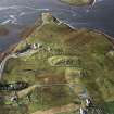 |
On-line Digital Images |
SC 1692254 |
RCAHMS Aerial Photography |
General oblique aerial view centred on the remains of the stone circle, chambered cairn and stone alignments with the farmhouse, visitor centre and township adjacent, taken from the NNE. |
25/9/2004 |
Item Level |
|
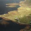 |
On-line Digital Images |
SC 1692255 |
RCAHMS Aerial Photography |
General oblique aerial view centred on the remains of the stone circle, chambered cairn and stone alignments with the farmhouse, visitor centre and township adjacent, taken from the ESE. |
25/9/2004 |
Item Level |
|
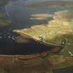 |
On-line Digital Images |
SC 1692256 |
RCAHMS Aerial Photography |
General oblique aerial view centred on the remains of the stone circle, chambered cairn and stone alignments with the farmhouse, visitor centre and township adjacent, taken from the ESE. |
25/9/2004 |
Item Level |
|
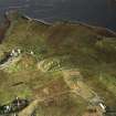 |
On-line Digital Images |
SC 1692257 |
RCAHMS Aerial Photography |
General oblique aerial view centred on the remains of the stone circle, chambered cairn and stone alignments with the farmhouse, visitor centre and township adjacent, taken from the NE. |
25/9/2004 |
Item Level |
|
 |
On-line Digital Images |
SC 2345336 |
Records of the Ordnance Survey, Southampton, Hampshire, England |
Lewis, Callanish, Pier, NB23SW 18, Ordnance Survey index card, Recto |
c. 1958 |
Item Level |
|