
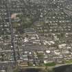
Helensburgh, Grant Street, Gasworks


Gas Holder (Modern), Gas Works (19th Century) - (20th Century)
Site Name Helensburgh, Grant Street, Gasworks
Classification Gas Holder (Modern), Gas Works (19th Century) - (20th Century)
Alternative Name(s) East Princes Street; Maitland Street; Helensburgh Gasworks
Canmore ID 41439
Site Number NS28SE 18
NGR NS 2985 8225
NGR Description Centred NS 2985 8225
Datum OSGB36 - NGR
Permalink http://canmore.org.uk/site/41439


- Council Argyll And Bute
- Parish Rhu
- Former Region Strathclyde
- Former District Dumbarton
- Former County Dunbartonshire
NS28SE 18 centred 2985 8225
Gas Holder [NAT] (at NS 29861 82263)
OS (GIS) MasterMap, November 2009.
The gasworks is depicted on the First Edition of the OS 6-inch map (Dumbartonshire, 1865-69, sheet xvii), which depictes the gas holders (gasometers) and associated buildings about 83m S of the North British Railway Co. railway terminus (NS 22978 82276).
The Ordnance Survey Object Name Book (ONB), describes the gasworks 'Gasworks with 3 gasometers situated on Maitland St. and Princes St., they are the property of a Joint Stock Company' (Name Book 1869).
At some point in the early 20th Century a larger gas holder was constructed 105m ESE (OS 25-inch c.1915). The present structure still stands about 51m to the NW suggesting that it has been moved a second time.
Information from RCAHMS (DE), December 2005.

