Margaret's Law, Haylie
Chambered Cairn (Neolithic)
Site Name Margaret's Law, Haylie
Classification Chambered Cairn (Neolithic)
Alternative Name(s) Hailie House; Haylie Chambered Tomb; Haylie House; Cathcart Road; Largs; Haco's Tomb
Canmore ID 41155
Site Number NS25NW 1
NGR NS 20945 58592
Datum OSGB36 - NGR
Permalink http://canmore.org.uk/site/41155
- Council North Ayrshire
- Parish Largs
- Former Region Strathclyde
- Former District Cunninghame
- Former County Ayrshire
NS25NW 1 20945 58592
(NS 2094 5858) Margaret's Law (NAT)
Burial Chamber (NR)
(Undated) OS map.
Location formerly entered as NS 2094 5858.
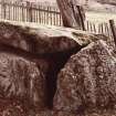
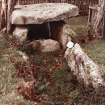
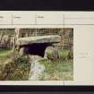
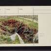
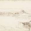
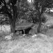
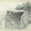
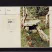
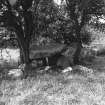
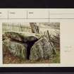
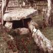
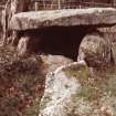
This burial chamber, also called 'Haco's Tomb', lies in pasture, on a gentle slope, between 100ft and 150ft OD. It was covered by a large cairn, "Margaret's Law', which was completely removed in 1772. The Clyde type chamber, with entrance to the E, measures 22ft by 3ft - 4ft wide, it probably had three compartments, but only the innermost remains intact, complete with capstone.
It is said that in 1772 two of the compartments contained five skulls each, while during excavations in 1954 parts of two skulls and other bones were found. A flint knife or scraper from here is in private possession. A broken, brown earthen urn (OSA 1796) or several earthen urns were also found in the chamber in 1772.
A S Henshall 1972.
This burial chamber is as described.
Surveyed at 1:2500.
Visited by OS (WDJ), 27 October 1964.
No change. The limits of the chamber are fenced off from the paddock field in which it is situated. A private notice board names it 'Haylie Chambered Tomb'.
Visited by OS (JRL), 2 January 1983.
Margaret's Law [NAT]
Burial Chamber [NAT]
OS (GIS) MasterMap, November 2009.
Field Visit (September 1942)
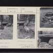
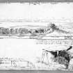
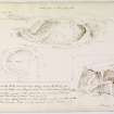
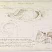
This chamber, all that remains of St Margaret’s Mound, opened in 1772, stands on the [broad] of the 25’ beach at the foot of Hailzie Brae, just behind Douglas Park, and consists of the capstone, headstone, three side-stones and a septal stone orientated E and W. The complete inner compartment is 6’6” long and 3’6” wide and is covered by a capstone 8’2” long x 6’6” wide by 1’2” thick which projects 1’6” E of the septal slab. The chamber is partly full of earth and rubbish so that the full height of the supporters cannot be determined. But the lateral slab on the S is 7’ long 1’10” thick and rises 3’8” above the present bottom of the chamber. The N slab is 6’10” long x 1’2” thick. Beyond its E end but not quite touching it a second stone, 4’10” long, continues the same line, but this stone s not higher than the septal slab and only just projects above the turf. The septal slab is 10” think, its upper edge is 1’8” below the capstone and it is set about 1’10” back from the E end of the N upright, but the corresponding end of the S upright has been trimmed to accommodate the septal stone. The E compartment is full of earth and stones up to the top of the septal stone’ the S side-stone as well as the portal or passage, if any, is missing.
The headstone at its base fits closely between the side-slabs, but as it is not strictly rectangular there is a gap of 9” between its top and the N side-stone but it helps to sustain the capstone.
No sign of the covering of the cairn survives.
Visited by RCAHMS (VGC), September 1942.
Project (4 July 2015 - 5 July 2015)
NS 20945 58592 (Canmore ID: 41155, SMR ID: 5730) Haylie Chambered Cairn is a scheduled monument dating to 3630–3350 BC. It sits at the S end of Largs and is in close proximity to Haylie House Care Home. The Adopt-a-
Monument Scheme worked with local volunteers, the Largs and District Museum and Historical Society and the North Ayrshire District Ranger Service, 4–5 July 2015. The work aimed to raise awareness of the existence of the cairn, undertook sensitive vegetation clearance and provided training in photogrammetry with the aim of building capacity in the area for future heritage volunteer projects and longer term understanding and management of the site.
Archive and report: NRHE (intended)
Funder: HLF and HES
Fiona Watson – Archaeology Scotland
(Source: DES, Volume 17)
Laser Scanning (18 March 2015)
NS 2094 5859 A laser scan survey of Haco’s Tomb was undertaken on 18 March 2015 for conservation management purposes. The survey was undertaken using a Trimble FX laser scanner controlled using spherical targets, located using a Trimble S6 total referenced to OS grid using a Trimble R6
GPS. Interpreted detail was surveyed in the field using the Trimble S6 total station, on the same grid as the control survey, allowing interpretation to be overlain on the laser scan data.
The Clyde type chamber of Haco’s Tomb lies on a broad terrace of the general W-facing slope above the town of Largs in a clearing in scrubby woodland with housing to the immediate W.
The western of the chamber compartments is intact with a capstone 2.5m by 1.8m sitting on three upright slabs. This intact compartment is separated from the rest of the chamber by a septal slab leaving a gap 0.4m high. Three upright slabs and a septal slab survive to the E of the intact chamber in a deep hollow which marks the extent of the chamber. Immediately to the N of the chamber lies a mound of recent origin, which may well be a spoil heap
from antiquarian excavations. No trace of the extent of the cairn can now be identified, however the statistical account reports that a huge cairn known as St Margerets Law was removed in 1772, exposing the chamber visible today. A reputed 15,000 cart-loads of rubble were removed from the cairn.
Archive: National Record of the Historic Environment (NRHE) intended
Funder: Forestry Commission Scotland
Jamie Humble – AOC Archaeology Group
(Source: DES, Volume 16)


![Haylee [Haylie] Megalithic Cist.](http://i.rcahms.gov.uk/canmore/l/SC01447360.jpg)
![Haylee [Haylie] Megalithic Cist.](http://i.rcahms.gov.uk/canmore/l/SC02262005.jpg)


![Haylee [Haylie] Megalithic Cist.](http://i.rcahms.gov.uk/canmore/l/SC01447361.jpg)


![Haylee [Haylie] Megalithic Cist.](http://i.rcahms.gov.uk/canmore/l/SC02262004.jpg)


![Haylee [Haylie] Megalithic Cist.](http://i.rcahms.gov.uk/canmore/s/SC01447360.jpg)
![Haylee [Haylie] Megalithic Cist.](http://i.rcahms.gov.uk/canmore/s/SC02262005.jpg)

![Haylee [Haylie] Megalithic Cist.](http://i.rcahms.gov.uk/canmore/s/SC01447361.jpg)


![Haylee [Haylie] Megalithic Cist.](http://i.rcahms.gov.uk/canmore/s/SC02262004.jpg)
