Following the launch of trove.scot in February 2025 we are now planning the retiral of some of our webservices. Canmore will be switched off on 24th June 2025. Information about the closure can be found on the HES website: Retiral of HES web services | Historic Environment Scotland
Great Cumbrae Island, Craigengour
Standing Stone (Prehistoric)
Site Name Great Cumbrae Island, Craigengour
Classification Standing Stone (Prehistoric)
Canmore ID 40618
Site Number NS15NE 15
NGR NS 1761 5641
Datum OSGB36 - NGR
Permalink http://canmore.org.uk/site/40618
- Council North Ayrshire
- Parish Cumbrae
- Former Region Strathclyde
- Former District Cunninghame
- Former County Buteshire
NS15NE 15 1761 5641.
(NS 1761 5641) Standing Stone (NR)
OS 25" map (1896)
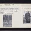
The stone stands about 6ft high and 14 inches broad. It is supposed to be a memorial to some of the Norwegians who fell at the Battle of Largs in 1263.
Name Book 1855
This stone is known as the Gouklan Stone. There are eight large boulders nearby, and two other pillars are reported to have been closely associated with it. A circle of pits dug around the stone revealed nothing.
W Lytteil 1886; J K Hewison 1893
The stone is as described in the Ordnance Survey Name Book (ONB). It was pulled down some years ago by vandals but has since been re-erected and set in concrete. The north face of the stone has been smoothed and a list of initials inscribed. Nothing was seen of the boulders noted by Lytteil and the name Gouklan is not known locally where the stone is referred to as the 'Druids stone'.
Visited by OS (JTT) 6 November 1964


