|
Photographs and Off-line Digital Images |
C 9517 |
RCAHMS Aerial Photography |
Oblique aerial view centred on Little Dunagoil fort, showing field boundaries, cultivation remains, cist and farmstead, taken from NE. |
1993 |
Item Level |
|
|
Photographs and Off-line Digital Images |
C 9518 |
RCAHMS Aerial Photography |
Oblique view of Dunagoil and Little Dunagoil (in foreground), showing cultivation remains, cist, and field boundaries, taken from the N. |
1993 |
Item Level |
|
|
Photographs and Off-line Digital Images |
C 9519 |
RCAHMS Aerial Photography |
Oblique aerial view. |
1993 |
Item Level |
|
|
Photographs and Off-line Digital Images |
C 9521 |
RCAHMS Aerial Photography |
Oblique aerial view of Dunagoil fort and Little Dunagoil (top left), showing cultivation remains, cist, and field boundaries, taken from W. |
1993 |
Item Level |
|
|
Photographs and Off-line Digital Images |
C 9527 |
RCAHMS Aerial Photography |
Oblique aerial view showing forts, cist (at centre right), cultivation remains and field clearance cairns, taken from N. |
1993 |
Item Level |
|
|
Photographs and Off-line Digital Images |
C 9523 |
RCAHMS Aerial Photography |
Oblique aerial view of Dunagoil, showing cultivation remains and field boundaries, taken from S. |
1993 |
Item Level |
|
|
Photographs and Off-line Digital Images |
C 9522 |
RCAHMS Aerial Photography |
Oblique aerial view of Dunagoil (centre) showing cultivation remains, cist, and field boundaries, taken from SW. |
1993 |
Item Level |
|
|
Photographs and Off-line Digital Images |
C 9520 |
RCAHMS Aerial Photography |
Oblique aerial view of Dunagoil (bottom right) and Little Dunagoil (middle left) showing field boundaries, cultivations remains and cist, taken from NW. |
1993 |
Item Level |
|
|
Photographs and Off-line Digital Images |
C 9524 |
RCAHMS Aerial Photography |
Oblique aerial view. |
1993 |
Item Level |
|
|
Photographs and Off-line Digital Images |
C 9526 |
RCAHMS Aerial Photography |
Oblique aerial view showing fort, cist, field clearance cairns, structures and rig, taken from E. |
1993 |
Item Level |
|
|
Photographs and Off-line Digital Images |
C 9525 |
RCAHMS Aerial Photography |
General oblique view, taken from the SE. |
1993 |
Item Level |
|
|
Photographs and Off-line Digital Images |
A 53699 PO |
Audrey S Henshall |
General view of cist |
1968 |
Item Level |
|
|
Photographs and Off-line Digital Images |
A 53700 PO |
Audrey S Henshall |
View of cist. |
1968 |
Item Level |
|
 |
On-line Digital Images |
DP 066390 |
Records of the Royal Commission on the Ancient and Historical Monuments of Scotland (RCAHMS), Edinbu |
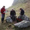
RCAHMS staff (Angela Gannon, Ian Parker and George Geddes) discuss the burial chamber at Dunagoil. |
20/3/2009 |
Item Level |
|
 |
On-line Digital Images |
SC 1157750 |
|
RCAHMS 1943 Description |
25/5/1943 |
Item Level |
|
|
Photographs and Off-line Digital Images |
DP 069210 |
Records of the Royal Commission on the Ancient and Historical Monuments of Scotland (RCAHMS), Edinbu |
View from NW with RCAHMS staff. Black and white duplicate of DP066390. |
20/3/2009 |
Item Level |
|
 |
On-line Digital Images |
DP 069212 |
RCAHMS Field Survey Digital Photography |
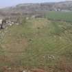
View from the SW. |
20/3/2009 |
Item Level |
|
|
Digital Files (Non-image) |
GV 004726 |
Records of the Royal Commission on the Ancient and Historical Monuments of Scotland (RCAHMS), Edinbu |
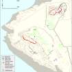
Plan of Dunagoil and Little Dunagoil forts and their environs |
8/2010 |
Item Level |
|
 |
On-line Digital Images |
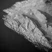
SC 1207479 |
RCAHMS Aerial Photography |
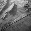
General oblique view, taken from the SE. |
1993 |
Item Level |
|
 |
On-line Digital Images |
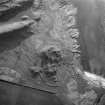
SC 1207480 |
RCAHMS Aerial Photography |
Oblique aerial view of Dunagoil, showing cultivation remains and field boundaries, taken from S. |
1993 |
Item Level |
|
 |
On-line Digital Images |
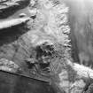
SC 1207492 |
RCAHMS Aerial Photography |
Oblique aerial view centred on Little Dunagoil fort, showing field boundaries, cultivation remains, cist and farmstead, taken from NE. |
1993 |
Item Level |
|
 |
On-line Digital Images |
DP 097432 |
Records of the Royal Commission on the Ancient and Historical Monuments of Scotland (RCAHMS), Edinbu |
Plan of Dunagoil and Little Dunagoil forts and their environs. |
8/2010 |
Item Level |
|
 |
On-line Digital Images |
SC 1723950 |
RCAHMS Aerial Photography |
Oblique aerial view centred on Little Dunagoil fort, showing field boundaries, cultivation remains, cist and farmstead, taken from NE. |
1993 |
Item Level |
|
 |
On-line Digital Images |
SC 1723951 |
RCAHMS Aerial Photography |
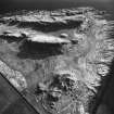
Oblique view of Dunagoil and Little Dunagoil (in foreground), showing cultivation remains, cist, and field boundaries, taken from the N. |
1993 |
Item Level |
|


