Holy Island, St Molaise's Cave
Cave (Period Unassigned), Cross Incised Rock (Early Medieval), Rune Inscribed Rock (Norse)
Site Name Holy Island, St Molaise's Cave
Classification Cave (Period Unassigned), Cross Incised Rock (Early Medieval), Rune Inscribed Rock (Norse)
Canmore ID 40079
Site Number NS02NE 4
NGR NS 05869 29732
Datum OSGB36 - NGR
Permalink http://canmore.org.uk/site/40079
- Council North Ayrshire
- Parish Kilbride
- Former Region Strathclyde
- Former District Cunninghame
- Former County Buteshire
NS02NE 4 0586 2972.
(NS 0586 2972) St Molio's Cave (NR)
OS 6" map, (1924)
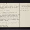
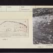
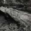
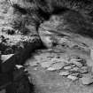
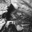
St Molaise's Cave was excavated by Balfour in 1908. It is 38 1/2ft long by 13ft at its widest, near the foot of the stone stair leading to it. It is paved from the middle to the NE corner. A large stone, 5ft 11ins x 1ft 8 ins x 1ft 8ins is set in the paving. at the SW end, when 3ft of soil and loose stones had been removed, a shell-midden and animal bones were found. They had slipped down over a hearth. A dry-stone wall, 5ft 3ins thick is at the S end of the cave; a similar wall, fallen almost completely into the cell, ran from the stair to the N end. Probably this was originally 8-10ft high. The roof and sides of the cave are covered with many marks and crosses, also 11th-13th century Runic inscriptions. The saint's name is usually written Molaise, an archaic genitive, but sometimes Moloise, the modern genitive, or Molios, which is the result of a confusion (Balfour 1910), Molaise is a reduced form of Laisren with "mo" (my) prefixed.
He died in 639 (Mackenzie 1914).
J Balfour 1909; 1910; D Wilson 1863; W M Mackenzie 1914.
Field Visit (18 November 1977)
St Molaise's Cave; name verified.
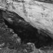
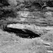
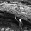
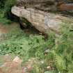
The "Cave" is a sandstone cliff overhang, and is as described and planned by Balfour.
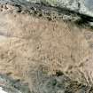
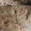
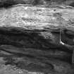
The paving is of regular sized, shaped slabs and the large stone, almost flush with the paving, is unmarked and of unknown purpose. Several niches carved into the rear wall are possibly authentic, and the overhang roof, particularly on the N side is covered in worn scratched crosses and clear Runic inscriptions. Above the overhang on the S side is an elaborately carved Latin cross about 20 cms long.
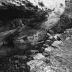
The dry-stone retaining wall along the open W side is at ground level externally but is 1.3m deep internally. It is in good repair as is the walling at the S end.
Surveyed at 1:10 000.
Visited by OS (J R L) 18 November 1977.
Reference (2001)
ST MOLAISE'S CAVE
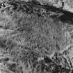
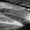
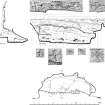
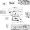
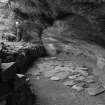
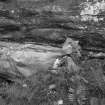
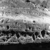
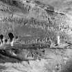
The 'cave' is a rock-shelter about 10m above high-water mark, formed by wave-action in bands of red and yellow sandstone, and the lower part of its inner wall is rounded and smoothed. In front of it there is an accumulation of soil, some of it spoil from Balfour's excavation in 1909, contained by a rebuilt revetment-wall 1m high, and at its S end a rough flight of steps leads down to the interior. The cave is roughly D-shaped, measuring 12m from NNW to SSE by 4m in maximum width, and the roof rises steadily from near floor-level at the E to a height of 3m at the front. Balfour cleared the N part down to a paved floor, which was renewed in 1992, and at the S end he found midden-material and a hearth, of uncertain date (1). The level at which many of the crosses and inscriptions are cut suggests that the ground-level outside the cave had risen considerably since the period of original occupation.
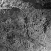
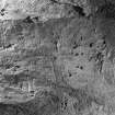
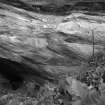
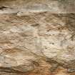
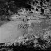
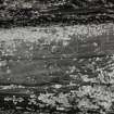
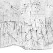
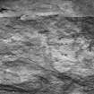
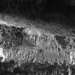
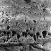
The carvings described here fall into two groups: (a) a large number of simple crosses, some perhaps associated with hermit use and others with pilgrim devotion, and (b), a series of Norse runic inscriptions, principally personal names, of which at least one was associated with the Norwegian expedition of 1263. However the two groups are not exclusive since some of the crosses appear to be contemporary with this inscription, and it may be that the Norse visitors themselves came as pilgrims. With the exception of an isolated cross (A) on the cliff-face S of the cave, and a few on the vertical face overhanging its mouth, most of the carvings now identifiable are on the sloping roof. They occur mainly towards the N end, or on ledges related to the varying consistency of the bands of sandstone. Some parts are heavily eroded, and in the area of densest carving damage may have been caused by a large inscription containing the date 1877.
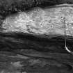
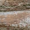
The isolated cross (A) is carved on the cliff-face above a steep slope rising from the S end of the cave and immediately N of a modern retaining-wall. It is a pecked Latin cross, 0.26m high and 0.24m in span, with large triangular terminals which in the top arm and shaft are D-shaped. The centre of the head is enclosed by a ring 85mm in diameter. Most of the carvings, including all of those on the overhang outside the cave (D, E, F), are small incised or sunken crosses, of both equal-armed and Latin type. On the roof at the centre of the cave, and 2m above the paving-level, there is a shallow sunken Latin cross (B) with expanded arms, 0.28m high and 0.22m in span, itself having a linear cross cut on the shaft. Three other crosses (C, H, I), of similar character but with shorter shafts, are carved on a vertical face at the N end, 2.5m above the paving. The lower edge of this face bears several small thinly-incised crosses, mostly equal-armed or with the arms at mid-height, and many more have been cut on the roof-slope below this overhang, which at the N end appears to have been cut back to give a smooth surface.
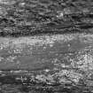
The same surface bears the highest and most prominent of the group of runic inscriptions (VIII), at a height of about 2.2m above present floor-level. Some at least of the small crosses appear to be incised with a tool similar to that used for this inscription and may be contemporary with it. The other inscriptions are on a fairly vertical rock-face, at heights ranging from 1.5m to 1.75m. Several other 'rune-like symbols' in the same area are affected by weathering and later graffiti. The following readings have been provided by Professors M F Barnes and R I Page. The reference-numbers to be used in their forthcoming Corpus are given after Olsen's standard numbering of 1912, which begins at the lowest level.
(I; SC 3) The most boldly-cut of the inscriptions, 0.34m long and with letters up to 54mm high. It was severely damaged, apparently deliberately, in or before 1882, and subsequent readings depend heavily on Wilson's illustration.
(+n)[ik]ul[os][*][ahaeni]+raeist
Nikolas a Haeni reist
'Nikolas from Haen carved'
There are several farms in Norway with the name Haen. Some of the rune-forms suggest a date no earlier than the 12th century.
(II; SC 4) A shallow inscription, 63mm long and with letters from 19mm to 90mm high.
suaein
This represents the personal name Sveinn. The rune-form used for 'ae' suggests a date no earlier than the 12th century.
(III; SC 5) A thinly-cut inscription, 80mm long and with letters from 20mm to 30mm high.
ono(n)tr:r(a)*st:ru
'Onundr carved runes'
(IV; SC 6) A firmly-cut inscription, 35mm long with letters from 24mm to 40mm high.
(a)mutar
This probably represents the name Amundr, and the form used for 't' suggests a date no earlier than the end of the 12th century.
(V; SC 12) An inscription 40mm long, whose characters diminish in height and firmness from 49mm at the left to 21mm at the right. It probably represents the name Olafr, although the fourth character is ambiguous.
ola(b)r
(VI; SC 9) An inscription 35mm long with characters from 31mm to 48mm high.
ioan
This probably represents the name Joan ('John'), and the significance of the additional markings recorded in the damaged area to the right by Roger in 1859 (2) is uncertain.
(VII; SC 13) A single character 57mm high, possibly the runic letter m.
(VIII; SC 7) The highest inscription, carved on the sloping roof of the cave with the lower parts of several letters extending round a change in its angle. It is 0.61m long and the characters vary from 96mm to 245mm in height, but are thinly incised. Some show signs of double cutting, perhaps because of the difficulty of access to the surface.
uiklaeikr s*allariraeiss(t)
Vigleikr stallari reist
'Vigleikr the marshal carved'
The carver was presumably the Vigleikr prestsson who was one of the leaders of Hakon Hakonarson's expedition of 1263 (3), and may possibly be identified with the Vigleikr stallari who was a prominent Norwegian royal official in the following decade. The runes are closely associated with a large group of simple crosses which may have been carved at the same time, and it is possible that some of the other inscriptions may also date from the visit of the Norwegian fleet to the adjacent anchorage.
Footnotes:
(1) Balfour 1910, 1, 255-7 and pl.46.
(2) Roger 1885, 379, fig.1; drawing dated 1859 in Stephens collection, Lund University, Sweden (information from Professor R I Page).
(3) Anderson 1922, 2, 617, 625.
Wilson 1863, 2, 279-81; Roger 1885, 378-80; Olsen, M, in Videnskapsselskapets Skrifter, 2 (1912); Balfour 1910, 1, 261-7 and 2, 23-4; Olsen, M, in Shetelig 1940-54, 6, 169; Liestol, 'Runes', 237; Fisher 2001, 62-3.


