Pricing Change
New pricing for orders of material from this site will come into place shortly. Charges for supply of digital images, digitisation on demand, prints and licensing will be altered.
Upcoming Maintenance
Please be advised that this website will undergo scheduled maintenance on the following dates:
Thursday, 9 January: 11:00 AM - 3:00 PM
Thursday, 23 January: 11:00 AM - 3:00 PM
Thursday, 30 January: 11:00 AM - 3:00 PM
During these times, some functionality such as image purchasing may be temporarily unavailable. We apologise for any inconvenience this may cause.
Loch Glashan
Dun (Prehistoric)
Site Name Loch Glashan
Classification Dun (Prehistoric)
Canmore ID 40067
Site Number NR99SW 8
NGR NR 9227 9301
Datum OSGB36 - NGR
Permalink http://canmore.org.uk/site/40067
- Council Argyll And Bute
- Parish Kilmichael Glassary
- Former Region Strathclyde
- Former District Argyll And Bute
- Former County Argyll
NR99SW 8 9227 9301.
(NR 9227 9301) Fort (NR)
OS 6" map (1900)
A circular, galleried (H Fairhurst 1969) dun, 63' in diameter within walls 13' thick, some of the stones being very large and the faces standing to 3' high on the outside and 4' on the inside.
The entrance passage is 5'10" wide at the outer end with door-checks, 3'4" inside. The inner end is ruined. There are possible huts on the W.
M Campbell and M Sandeman 1964
This dun now lies in the centre of a forestry plantation. No trace of huts on the W were found.
Visited by OS (RD) 2 April 1970
Scheduled as Dun, 260m E of Loch Glashan... a later prehistoric dun or defensive dwelling, sited on a ridge above Loch Glashan.
Information from Historic Scotland, scheduling document dated 19 November 2003.
NR 9227 9301 A detailed survey of Loch Glashan dun was carried out over two weeks in June 2003, with small-scale excavation to assess the extent of damage caused by encroaching vegetation and to obtain dating evidence for the construction of the site. This work led to the production, in collaboration with Forest Enterprise, of a preservation strategy for the site. Finds include a polished stone, a hammerstone and a yellow glass bead.
Sponsors: HS, University of Nottingham.
S Gilmour and J C Henderson 2003
Field Visit (May 1980)
This dun stands within thick forest on a knoll which, before afforestation, overlooked the E side of Loch Glashan (Campbell and Sandeman 1964); it is about 300m NE of the N tip of the hydro-electric dam and 250m E of the present shore of the loch. Constructed of large angular boulders, the dun measures about 20m in diameter within a wall some 4m in thickness, with long stretches of both inner and outer facing-stones remaining in position, the outer standing to a height of 1.7m and the inner to a height of 1.2m in five irregular courses. The outer face is now difficult to see because of the overhanging conifers. There is clear evidence of the presence of a median face within the wall on the E, and on the W this is indicated by a central hollow and by a short stretch of walling. The entrance, which is on the NE, measures 1.7m in width at the outer end, with individual jamb-stones forming rebates at a distance of 1m from the outside; at this point the N passage-wall has been set back about 0.15m, but the inner portion of the opposite passage-wall is obscured by rubble, and the internal passage-width is thus uncertain. The N jamb-stone measures 0.9m in height and 0.4m by 0.18m, and its partner on the S side is 1.1m high and 0.55m by 0.15m at the base. Several later enclosures and shelters shown on the plan (RCAHMS 1988) have employed either the inner face of the dun wall, or the median wall-face, for part of their construction.
RCAHMS 1988, visited May 1980.
Measured Survey (9 May 1982)
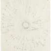
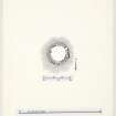
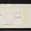
RCAHMS surveyed Loch Glashan dun on 09 May 1982 with plane-table and alidade producing a plan at a scale of 1:100. The plan of the dun was redrawn in ink and published at a scale of 1:250 (RCAHMS 1988a, 195).


