
Following the launch of trove.scot in February 2025 we are now planning the retiral of some of our webservices. Canmore will be switched off on 24th June 2025. Information about the closure can be found on the HES website: Retiral of HES web services | Historic Environment Scotland
Oronsay, Cill Moire


Burial Ground (Early Medieval) - (Medieval), Chapel (Early Medieval) - (Medieval)
Site Name Oronsay, Cill Moire
Classification Burial Ground (Early Medieval) - (Medieval), Chapel (Early Medieval) - (Medieval)
Alternative Name(s) Cill Mhoire; Kilmory; Kilmary
Canmore ID 37798
Site Number NR38NE 1
NGR NR 36005 88837
Datum OSGB36 - NGR
Permalink http://canmore.org.uk/site/37798


- Council Argyll And Bute
- Parish Colonsay And Oronsay
- Former Region Strathclyde
- Former District Argyll And Bute
- Former County Argyll
NR38NE 1 3600 8883.
(NR 3602 8882) Cill Mhoire (NR)
OS 6" map (1900)
Cille Mhoire (S Grieve 1923), Kilmory (J de V Loder 1935) or Kilmary (W Stevenson 1881), the site of a chapel dedicated to the Virgin Mary situated within an unenclosed burial ground. The chapel, whose foundation was still traceable in 1881, was rectangular in plan, measuring 20' x 15'. The burial ground is said to be the predecessor of the Priory burial ground (NR38NW 1) and, as was the practice in unenclosed burial grounds, each burial was covered with a cairn of stones with an upright stone at the head and foot. These are still visible. This was one of the resting places for funeral parties on the way to the Priory burial ground.
Name Book 1878
NR 3600 8883: The remains of the chapel measure 4.9m E-W by 3.7m within a double-faced stone wall 0.9m thick and up to 0.5m high. The entrance lay on the W. There is now no trace of the burial cairns, the only feature remaining being a small unmarked upright slab, 5.0m N of the chapel.
Surveyed at 1:2500.
Visited by OS (DWR) 18 April 1974
Measured Survey (1977)
RCAHMS surveyed the chapel at Cill EMhoire at a scale of 1:100. The plan was redrawn in ink and published at a reduced scale (RCAHMS 1984, fig. 26F and 166E).
Field Visit (April 1978)
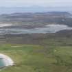
NR 360 888. The turf-covered remains of this small subrectangular building are situated about 80m S of the track to Oronsay Priory (RCAHMS 1984, No. 386). It is a round-angled structure which is aligned E-W and measures 5.5m by 3.5m transversely within walls 1m thick and 0.35m in maximum height. The dedication was evidently to St Mary.
RCAHMS 1984, visited April 1978.

