Islay, Caisteal Mhic Dhomhnuill
Cairn (Later Prehistoric)(Possible)
Site Name Islay, Caisteal Mhic Dhomhnuill
Classification Cairn (Later Prehistoric)(Possible)
Canmore ID 37643
Site Number NR35NE 1
NGR NR 36443 59949
Datum OSGB36 - NGR
Permalink http://canmore.org.uk/site/37643
- Council Argyll And Bute
- Parish Killarow And Kilmeny
- Former Region Strathclyde
- Former District Argyll And Bute
- Former County Argyll
NR35NE 1 3644 5994.
(NR 3644 5992) Caisteal Mhic Dhomhnuill (NR) (Site of)
OS 6" map, Argyllshire, 2nd ed., (1900)
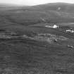
This feature is a raised green knoll, said to be the remains of a castle of the Macdonalds.
Name Book 1878
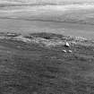
The mutilated and partially turf covered remains of a cairn up to 25m in diameter and surviving to a height of 1m.
Divorced survey at 1:2500.
Visited by OS (BS) 10 June 1978.
Field Visit (June 1975)
NR 364 599. Situated on a level shelf 500m SE of Neriby, and overlooking the Mulindry Bridge over the River Laggan, there is an accumulation of small stones spread over an area measuring about 22m across. Numerous robber-scoops, visible both round the perimeter and elsewhere, indicate that many stones have been removed, leaving the remainder surviving to a height of up to 1m.
RCAHMS 1984, visited June 1975


