Pricing Change
New pricing for orders of material from this site will come into place shortly. Charges for supply of digital images, digitisation on demand, prints and licensing will be altered.
Upcoming Maintenance
Please be advised that this website will undergo scheduled maintenance on the following dates:
Thursday, 9 January: 11:00 AM - 3:00 PM
Thursday, 23 January: 11:00 AM - 3:00 PM
Thursday, 30 January: 11:00 AM - 3:00 PM
During these times, some functionality such as image purchasing may be temporarily unavailable. We apologise for any inconvenience this may cause.
Islay, Frachdale
Chambered Cairn (Neolithic)
Site Name Islay, Frachdale
Classification Chambered Cairn (Neolithic)
Canmore ID 37607
Site Number NR34NW 4
NGR NR 31054 46934
Datum OSGB36 - NGR
Permalink http://canmore.org.uk/site/37607
- Council Argyll And Bute
- Parish Kildalton And Oa
- Former Region Strathclyde
- Former District Argyll And Bute
- Former County Argyll
NR34NW 4 3105 4693.
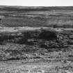
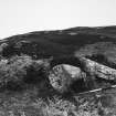
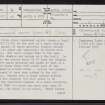
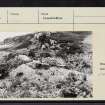
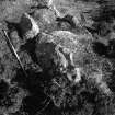
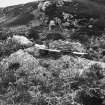
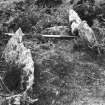
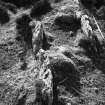
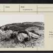
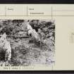
NR 310 469 A Clyde group chambered cairns crowns a knoll (just below 250ft OD) at the side of a small valley. Only a small amount of cairn material remains around the chamber; its edges are impossible to define with any confidence. The cairn slopes down to the east in front of the chamber and merges with the knoll. On the north side two stones about 25ft from the chamber appear to revet cairn material and might be part of a kerb. Another stone about 20ft south west of the chamber may also be a kerb stone. Behind the chamber the cairn appears to have been robbed to the old ground surface. Beyond this a stony spread extends to 60ft from the chamber, but this seems to be derived from the scattered remains of a small building. It is unlikely that the cairn was much more than 50ft in diameter, its shape is uncertain. Three stones of the chamber walls, and a septal slab remain, about 1 1/2ft above the turf; the chamber axis lies just west of north to south of east, with the entrance at the latter end, where there are three large irregular blocks of stone, probably two portals with a stone either fallen from the chamber roof, or used to block the entrance, between them.
A S Henshall 1972, visited 1962.
NR 3105 4693 The remains are generally as described.
No surrounding cairn material is evident, and its former extent is conjectural.
Surveyed at 1:10000.
Visited by OS (JRL) 8 June 1978.
Field Visit (May 1979)
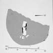
NR 310 469 .This chambered cairn occupies a small knoll 500m W of the ruins of Frachdale on the SW side of an unnamed stream. The cairn material has been severly robbed, but four possible kerb-stones, as shown on the plan (RCAHMS 1984), suggest a cross-measurement of about 15m; the original shape, however, is unknown. The chamber is aligned almost E-W, with the entrance facing E; in front of it the two massive portal stones now lie dislodged, with a third large stone between them. The three surviving side-slabs, which are exposed to a height of about 0.5m, indicate that the chamber measures about 3.5m by 1m internally; a septal stone divides it into two unequal compartments.
RCAHMS 1984, visited May 1979.
Measured Survey (1979)
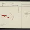
RCAHMS surveyed this chambered cairn with plane-table and alidade at a scale of 1:100. The resultant plan was redrawn in ink and published at the reduced scale of 1:250 (RCAHMS 1984, fig. 50A ).


