
Rowchoish


Bothy (20th Century) (1977), Shepherds Cottage (19th Century) - (20th Century), Township (Post Medieval)
Site Name Rowchoish
Classification Bothy (20th Century) (1977), Shepherds Cottage (19th Century) - (20th Century), Township (Post Medieval)
Canmore ID 375640
Site Number NN30SW 49
NGR NN 33617 04314
Datum OSGB36 - NGR
Permalink http://canmore.org.uk/site/375640

- Council Stirling
- Parish Buchanan
- Former Region Central
- Former District Stirling
- Former County Stirlingshire
Note (7 July 2022)
NN30NW 49 NN 33617 04314
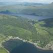
This bothy occupies a former byre, part of the 19th century shepherd’s farmstead situated in woodland at the foot of the NE slopes of Ben Lomond, 6.2km NNW of the public road at Rowardennan Lodge.
A township and farmland at ‘Ruechoise’ are shown on Roy’s Military Map (1747-55). The more detailed 1st edition of the OS 6-inch map depicts five roofed buildings, three garden enclosures and a series improved and perhaps cultivated patches of ground among woodland. Rowchoish was described at the time as ‘a well-known name applied to two cothouses. The property of the Duke of Montrose, and occupied by Donald McNab and John Swan’ (OS Name Book, Stirlingshire Book No. 6, p.32).
On the night of the 1881 census Rowchoish was occupied by three siblings, Donald (50), William (45) and Marey [sic] (47) Cameron. The men were listed as shepherds and Marey as a housekeeper.
Three unroofed buildings and one roofed building annotated ‘Rowchoish (Bothy)’ are depicted on the current edition of the OS 10,000 digital map.
Information form HES Archaeological Survey (D M Bratt) 7 July 2022
(Allan 2017, 226-7)

