Pricing Change
New pricing for orders of material from this site will come into place shortly. Charges for supply of digital images, digitisation on demand, prints and licensing will be altered.
Islay, Beinn Sholaraidh
Promontory Fort (Period Unknown)(Possible)
Site Name Islay, Beinn Sholaraidh
Classification Promontory Fort (Period Unknown)(Possible)
Canmore ID 37512
Site Number NR27SW 12
NGR NR 2224 7124
Datum OSGB36 - NGR
Permalink http://canmore.org.uk/site/37512
- Council Argyll And Bute
- Parish Kilchoman
- Former Region Strathclyde
- Former District Argyll And Bute
- Former County Argyll
NR27SW 12 2228 7118.
(NR 2230 7118) Fort
Information from RCAHMS to OS.
There are no certain traces of a fort on Beinn Sholaraidh, a cliff girt promontory sloping upwards towards the north west, and approachable only from the south east. Some loose stone lies on the summit and at the base of outcropping rock which extends part of the way across the promontory, but this appears to be eroded material and not tumble from a wall.
Visited by OS (N K B) 24 May 1979.
Field Visit (May 1979)
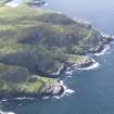
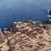
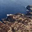
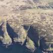
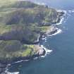
NR 222 711. On the summit of Beinn Sholaraidh, an elongated rocky headland on the NW coast of Islay, 100m NE of the fort NR27SW 5 and about 1.6km WNW of Sanaigmore farmhouse, there are the severely denuded remains of what has probably been a promontory fort. The summit is aligned approximately NW and SE, and on each flank steep rocky cliffs up to 30m high afford strong natural protection. The seaward end falls less abruptly in a series of rocky shelves, while from the SE moderately steep slopes offer an easier means of approach.
At the SE end of the summit there is a transverse rocky ridge which forms a natural barrier extending across almost the entire width of the promontory. For most of its SW half the landward side of the ridge presents a sheer rock-face 2.6m high, but to the NE it rises only a metre or so above the level of immediately adjacent ground. Between the SW end of the ridge and the cliff edge on that flank there are traces of a boulder-faced, rubble-cored wall 2.3m thick but at present only one course high, and an intermittent scatter of stony debris indicates the further course of the wall along the crest, leading towards the cliffs on the opposite flank. The area thus cut off by the wall measures about 85m from NW to SE by 33m transversely and is seamed with rocky spines and covered by heather. The position of the entrance is not apparent, but it probably lay somewhere in the NE half of the wall.
RCAMS 1984, visited May 1979
Note (29 September 2014 - 4 August 2016)
What may a fort situated on a rocky promontory on the NW coast of Islay was noted in 1979 by RCAHMS investigators, who believed that the stones scattered along a prominent rib of outcrop up to 2.6m high at the SE end of the summit were the remains of a defensive wall some 2.3m thick. The area apparently cut off on the summit measures about 85m from NW to SE by 33m transversely (0.22ha), but while the slopes defining the summit are steep and precipitous, on the seaward side it shelves down towards the sea, and the wall is thus controlling a much larger area of about 3ha. The surface of the whole promontory is rocky and uneven and no trace of an entrance has been observed.
Information from An Atlas of Hillforts of Great Britain and Ireland – 04 August 2016. Atlas of Hillforts SC2118


